Leaving Tseeb’s cabin in South Tahoe we did not get on the hill at Alpine Meadows until 10AM. Most of the east facing was in corn mode already on a bluebird day that probably reached 50F. Dave Bostedo, staying at Squaw on a short trip from the DC area, had been there an hour and taken 5-6 Summit runs. He’s here on one of our warmup runs from the Roundabout lift.

The majority of our runs were from Summit into Alpine Bowl and Wolverine Bowl. Both were expansive enough not to get chewed by skier traffic except a short skier’s left part of Alpine Bowl that gets people coming from Roundabout halfway down.
Tseeb, Dave and Lucia at top of Alpine Bowl with view of Lake Tahoe:

Wolverine Bowl:


Later we skied the north facing slot D6 into Wolverine.

Most ungroomed skiing was challenging. It had snowed 3 inches Tuesday and below the new snow rated to be icy. I found past noon that some of it was sun softened to be more manageable. Twice Tseeb and I took a low traverse under the Palisades to test the new snow.
There were also huge moguls under the Summit lift partway up where I ended up mostly zigzagging in variable snow. Corkscrew Gully skier’s left of that was more manageable.

Tseeb also led me to Peter’s Peril, which drops under the Gasex to the top of Roundabout.

Lower down the snow got heavier, but coming from Alpine Bowl the Charity and Ladies Slalom runs face north and held up best. Alpine Bowl itself was from SE to NE exposure and far skier’s right of it was good all the way to my 2PM departure after skiing 22,800 vertical.
The layout of Alpine is conducive to corn development that holds up for several hours. But it’s still much lower than Mammoth and I would say this day was comparable to a good Memorial Day at Mammoth.
It was also helpful for me to leave at 2PM as I had a drive north ahead of me. I used Highways 20, 70 and 99, eventually meeting I-5 at Red Bluff, where I had dinner and got a full charge. I drove another half hour and spent the night in Redding.
Passing by Chico I decided to take a half hour detour to Paradise, site of the catastrophic fire 30 months ago. Some lots remain vacant, though dead trees have been cleared so there are many tree stumps.

Some lots have new houses.

But more still have owners living in RV’s.

Paradise did not give me the impression of a remote mountain town. It's on a plateau only about 12 miles and 1,000 feet up from highway 70 in the Central Valley. But there are canyons on both sides of the plateau which accelerate the Diablo winds and those canyons were full of burned trees.
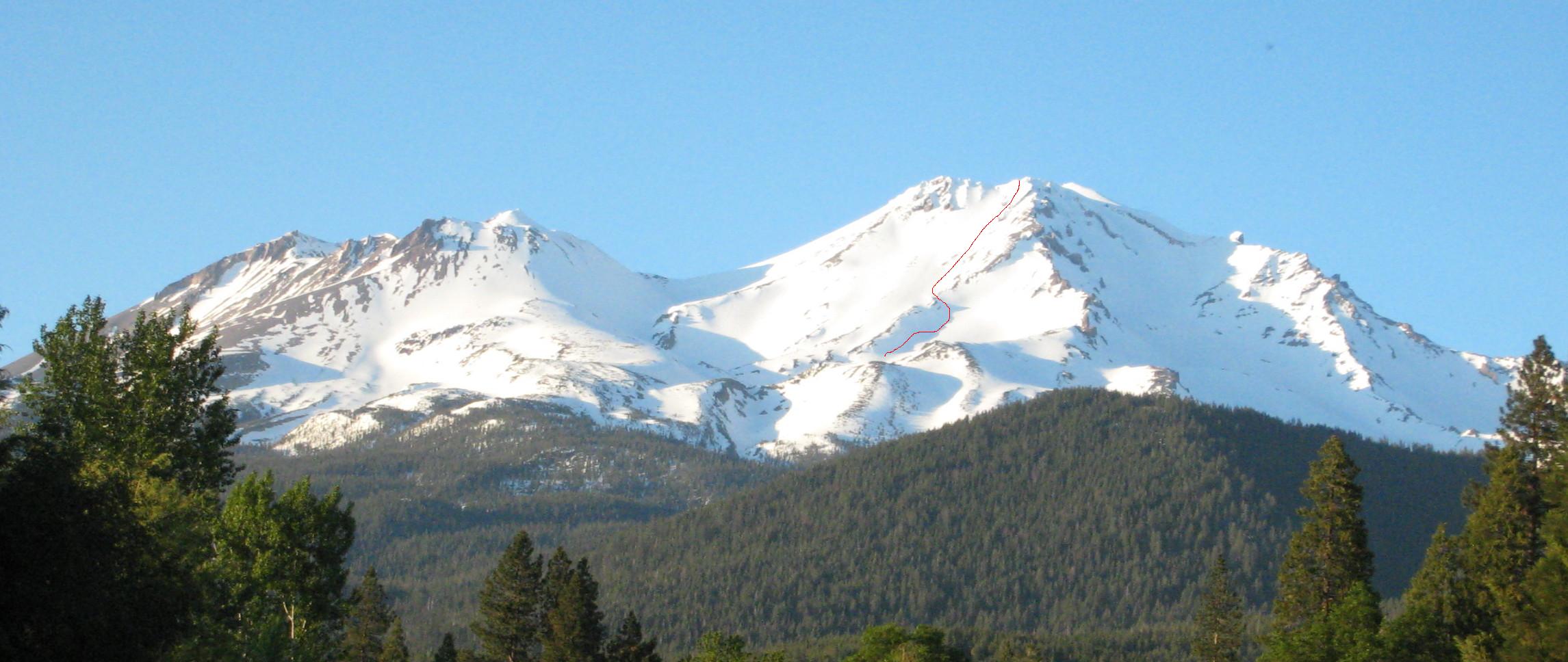
The next morning I stopped for breakfast in Mt. Shasta.

Shasta will not have much of a backcountry ski season this spring. Compare to June 19 of the big 2011 season:

I recall a hearty breakfast at the Black Bear Café after the guided ski tour in 2011 so that’s where I went. Mt. Shasta is its original location but it has expanded to over 50 places mostly in the Northwest. Most locations have carved wooden bears and this one is appropriate at Mt. Shasta.

Continuing north into Oregon I saw a few of these signs as I had on my drive Feb. 19-20.

The majority of our runs were from Summit into Alpine Bowl and Wolverine Bowl. Both were expansive enough not to get chewed by skier traffic except a short skier’s left part of Alpine Bowl that gets people coming from Roundabout halfway down.
Tseeb, Dave and Lucia at top of Alpine Bowl with view of Lake Tahoe:
Wolverine Bowl:
Later we skied the north facing slot D6 into Wolverine.
Most ungroomed skiing was challenging. It had snowed 3 inches Tuesday and below the new snow rated to be icy. I found past noon that some of it was sun softened to be more manageable. Twice Tseeb and I took a low traverse under the Palisades to test the new snow.
There were also huge moguls under the Summit lift partway up where I ended up mostly zigzagging in variable snow. Corkscrew Gully skier’s left of that was more manageable.
Tseeb also led me to Peter’s Peril, which drops under the Gasex to the top of Roundabout.
Lower down the snow got heavier, but coming from Alpine Bowl the Charity and Ladies Slalom runs face north and held up best. Alpine Bowl itself was from SE to NE exposure and far skier’s right of it was good all the way to my 2PM departure after skiing 22,800 vertical.
The layout of Alpine is conducive to corn development that holds up for several hours. But it’s still much lower than Mammoth and I would say this day was comparable to a good Memorial Day at Mammoth.
It was also helpful for me to leave at 2PM as I had a drive north ahead of me. I used Highways 20, 70 and 99, eventually meeting I-5 at Red Bluff, where I had dinner and got a full charge. I drove another half hour and spent the night in Redding.
Passing by Chico I decided to take a half hour detour to Paradise, site of the catastrophic fire 30 months ago. Some lots remain vacant, though dead trees have been cleared so there are many tree stumps.
Some lots have new houses.
But more still have owners living in RV’s.
Paradise did not give me the impression of a remote mountain town. It's on a plateau only about 12 miles and 1,000 feet up from highway 70 in the Central Valley. But there are canyons on both sides of the plateau which accelerate the Diablo winds and those canyons were full of burned trees.
The next morning I stopped for breakfast in Mt. Shasta.
Shasta will not have much of a backcountry ski season this spring. Compare to June 19 of the big 2011 season:
I recall a hearty breakfast at the Black Bear Café after the guided ski tour in 2011 so that’s where I went. Mt. Shasta is its original location but it has expanded to over 50 places mostly in the Northwest. Most locations have carved wooden bears and this one is appropriate at Mt. Shasta.
Continuing north into Oregon I saw a few of these signs as I had on my drive Feb. 19-20.
Last edited:
