Mountain View, CA – Internet giant Google took the first step yesterday to adding ski lifts and trails to its popular mapping product for the web and smart phones.
Initially offering ski data for 38 resorts across North America, including such popular destinations as Squaw Valley, Calif., and Whistler Blackcomb, British Columbia, Canada, as well as more obscure locales such as Alyeska, Alaska and Granite Gorge, N.H., the enhancements featuring ski lifts and runs drawn in the familiar green, blue and black color scheme are now visible both on a web browser and in Google Maps apps for smart phones, where the device’s GPS capability can be used to pinpoint the viewer’s location on the maps.

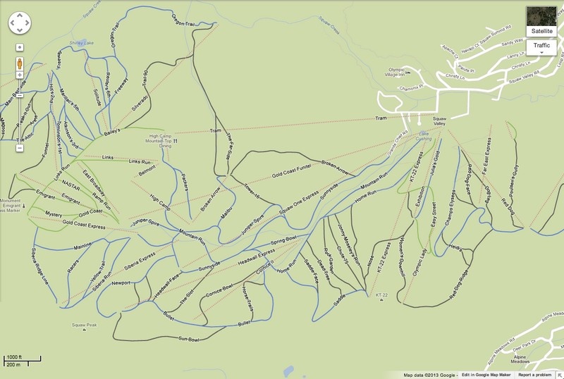
“Power up Google Maps on your Android device or iPhone, and the mountain information you need is right there. Blue, green and black runs are shown as solid colored lines and ski lifts are red dotted lines,” says Ryan Poscharsky, Strategic Partner Manager, Google Maps. “Ski resorts in Google Maps can also be helpful when you’re gearing up for a trip. You can check out the maps on your laptop browser to plot your course, and even get a Street View preview of a few select slopes before you head up the mountain.”
Our experience thus far with the enhancement, however, has produced mixed results. In a computer’s web browser the ski lift and run information is only viewable with the road map layer, and disappears when the far more useful “terrain” topographic layer is enabled. By contrast, ski lift names are visible with the terrain layer when using Google Maps for Android, but the red dotted lines denoting the lift’s position are gone, as are the ski runs. When viewed using the street map layer all ski-related features are restored in Android, but trails are only visible when zooming in to a degree that it’s difficult to understand the “big picture.” Lift lines, however, remain visible at a much wider view.
Unlike other ski resort mapping products available for smartphones, Google Maps is free. And while some of North America’s key resorts are noticeably absent from the initial release, including Snowbird and Alta in Utah, and Stowe and Killington in Vermont, developers promise that more ski resorts will be coming online soon. For now, here’s the list:
|
|