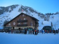
Another day at Alta with friends Eric K and his father Dan K, who are both visiting from Massachusetts.
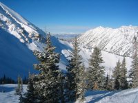
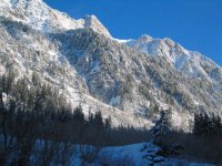
Temps were in the 20s at 9:15 when lifts opened under deep blue, cloudless skies. Miraculously, the heavy, wet snow from yesterday dried out overnight into absolute fluff in most places, although the wind made it heavier in a few spots. No complaints, though!
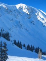
Our first couple of runs were on Baldy Shoulder, where we managed to find fresh snow. After that, it was off to Yellow Trail. We rode Sunnyside once just for a couple of hundred trackless verts on Vail Ridge, then hit No. 9 Express trees once again.
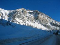
We had at that point planned for lunch, but riding Sugarloaf we saw the first stream of skiers traversing Devil's Castle when the patrol dropped the rope after bombing the cornice all morning. Yee-haa! Lunch would have to wait. :wink: A short bootpack was followed by a traverse to the center of Devil's Castle, where a whole lotta trackless windslab awaited. Fun, fun, fun!!
After lunch, we boarded the Collins lift at the angle station and sped out to the High T. Clouds from the pending storm had streamed in by this point, and the increasing winds had groomed Annie's smooth. Fun turns were had, and we kept traversing right into the lower reaches of No Name for more of the same.
I ended my day once again at 3:00 pm, this time after 14,409 verts. Came home and crashed for 2.5 hours! Photos are below, and here are some short videos. (Videos are encoded with the XviD codec -- if you don't already have it, you can download it for free here.)
Of course, I'm back to work tomorrow as yet another Sunday night/Monday storm system blows in. Here's the forecast:
Temps were in the 20s at 9:15 when lifts opened under deep blue, cloudless skies. Miraculously, the heavy, wet snow from yesterday dried out overnight into absolute fluff in most places, although the wind made it heavier in a few spots. No complaints, though!
Our first couple of runs were on Baldy Shoulder, where we managed to find fresh snow. After that, it was off to Yellow Trail. We rode Sunnyside once just for a couple of hundred trackless verts on Vail Ridge, then hit No. 9 Express trees once again.
We had at that point planned for lunch, but riding Sugarloaf we saw the first stream of skiers traversing Devil's Castle when the patrol dropped the rope after bombing the cornice all morning. Yee-haa! Lunch would have to wait. :wink: A short bootpack was followed by a traverse to the center of Devil's Castle, where a whole lotta trackless windslab awaited. Fun, fun, fun!!
After lunch, we boarded the Collins lift at the angle station and sped out to the High T. Clouds from the pending storm had streamed in by this point, and the increasing winds had groomed Annie's smooth. Fun turns were had, and we kept traversing right into the lower reaches of No Name for more of the same.
I ended my day once again at 3:00 pm, this time after 14,409 verts. Came home and crashed for 2.5 hours! Photos are below, and here are some short videos. (Videos are encoded with the XviD codec -- if you don't already have it, you can download it for free here.)
- Eric K and Dan K on Baldy Shoulder (5.87 MB)
- Yours truly, "Admin," on Baldy Shoulder (6.99 MB)
- Eric K on Baldy Shoulder (3.70 MB)
Of course, I'm back to work tomorrow as yet another Sunday night/Monday storm system blows in. Here's the forecast:
UTZ008-009-140600-
WASATCH MOUNTAINS SOUTH OF I-80-WESTERN UINTA MOUNTAINS-
350 PM MST SUN FEB 13 2005
...HEAVY SNOW WARNING IN EFFECT FROM 11 PM THIS EVENING TO 5 PM
MONDAY AFTERNOON...
THE NATIONAL WEATHER SERVICE IN SALT LAKE CITY HAS ISSUED A
HEAVY SNOW WARNING FOR THE WASATCH MOUNTAINS SOUTH OF I-80 AND THE
WESTERN UINTA MOUNTAINS. THE WARNING IS FOR THE PERIOD FROM 11 PM
THIS EVENING TO 5 PM MONDAY AFTERNOON.
SNOW WILL SPREAD ACROSS THE AREA TONIGHT. THE SNOW WILL TURN HEAVY
LATE TONIGHT AND CONTINUE MONDAY MORNING BEFORE SLOWLY DECREASING IN
THE AFTERNOON.
TOTAL ACCUMULATIONS OF 10-18 INCHES ARE EXPECTED IN THE HIGHER
ELEVATIONS WITH 5-10 INCHES BELOW ABOUT 7000 FEET.
THIS STORM WILL CREATE DIFFICULT DRIVING CONDITIONS LATE TONIGHT AND
MONDAY. DRIVERS SHOULD PLAN EXTRA TIME FOR TRAVEL IN THE WARNING AREA
TOMORROW.
REMEMBER...A HEAVY SNOW WARNING MEANS HAZARDOUS WEATHER CONDITIONS
ARE IMMINENT OR HIGHLY LIKELY.
