Dolomiti Superski (Cortina / Arabba / Val di Fassa / Val Gardena / Alta Badia, Italy): March 31 - April 3, 2024

ChrisC

Well-known member
After many below-average seasons, I decided Easter was the time to finally ski Italy after continuous mid-February-to-March snowfall. Initially, I was focused on Monterosa since they had received extreme snow—Champoluc was cut off by an avalanche in March.

However, I diverted at the last minute since the Easter storm was going to be too intense—30-60" of expected snow, but worse warm air—a possible rain line at 2000m+. The Monterosa website already hinted that the Alagna might be closed some days—the prime off-piste zone. This was the perfect mix for high avalanche potential and limited off-piste opportunities. So, I switched to the Dolomites (another bucket list destination) at the last minute. The weather forecast was for snow - lower amounts but still significant (20") and lower snow line 1000-1500m.

I was feeling good about my decision after reading the following post by Alta Badia-based (Corvara) ski guide, Francesco Tremolada (who wrote the book on 'Freeriding in the Dolomites'):

At the end of February, we had a long period of bad weather that finally brought some snow to the Dolomites. Conditions improved markedly, thanks to a nice base, especially at altitude. The month of March was then a succession of beautiful days, often with typically spring-like temperatures, and more bad weather and snow. In general, it was the best period ever for ski mountaineering and freeriding, also in relation to the past two seasons. This end of season, if the weather turns good again, could offer some super days of skiing and great steep descents. We’ll see. In the meantime, here are some photos of the last few days in the Dolomites.
The Dolomites/Dolomiti Superski is a vast ski region - some sections linked, some easily connected by an excellent bus system. If everything is combined and counted as one, it's larger than The 3 Vallees or Portes du Soliel - making it the largest ski area in the world. It has significant upsides (extent, scenery, endless cruising, snowmaking, food/wine, endless number of refugios, lower prices than most major resorts, history) and also downsides (erratic snow, weird off-piste policies, lack of on-piste expert terrain).

I decided to start the trip in stormy weather in Cortina and then later move to Arabba to ski the expert off-piste terrain (mostly couloirs/canales) under clear weather. Also, I knew this had to be a shorter trip - I always wanted to spend an entire week - so I would just try to hit the highlights and decide whether to return later.

I arrived late afternoon Saturday in Cortina to a mix of snow and rain. The town has charming village streets lined with quaint shops, cozy cafes, and elegant boutiques—full of Italians on Easter vacation. It is definitely a unique ski town and a classic on par with Chamonix, Zermatt, St. Moritz, Grindelwald, etc. However, due to the weather, one could not see its dramatic landscape, characterized by towering peaks, rugged cliffs, and picturesque valleys. And like most European ski towns this year, there was not much snow in town due to the lower 1200m elevation - despite a ton at altitude.

Skiing-wise, Cortina comprises 3 large areas: Tofana, Faloria/Cristallo, and Cinque Torri/Lagazuoi, and quite a few smaller ones:


Cortina 3 areas.jpg


Unfortunately, the following day, I woke up to heavy rain in town and revised weather forecasts of a possible snowline at 1800m. Initially, I expected to ski Cortina's most extensive area, Tofana; however, that needed to be revised since much of the area is below 1800m - or treeless higher runs - Ra Valles.

Therefore, I decided to ski Faloria/Cristallo since the cable car starts in town, and most slopes have trees and/or above 1700m:

Faloria.png


It was a good call, and it was heavily snowing when I arrived at the cable car top station at Faloria (2100m). I started to lap the Vitelli lift #54 that reached the Tondi summit (2300+m) and served a steep semi-open bowl. The terrain was low-expert, and the pistes could be combined with the next lift, #56, for decent vertical runs - all covered with 12" of new snow. All precipitation remained snow above the ski area low point of Rio Gere 1680m. Overall, it was perfect storm-day terrain since rocks or trees provided perspective. Also, it was my own private ski area (I could lay my tracks down side-by-side from each run) since Cortina/Italian skiers stayed inside. Maybe there were 50 skiers on the hill? Things stayed fresh all day, about 8-16 inches new.

One interesting piste was #62 - used in a past Olympics and likely for the upcoming Winter Games here in 2026:

"This black ski slope became famous during the 1956 Winter Olympics with the victory of the Giant Slalom gold medal by Toni Sailer. It is a continuous succession of steep and flat sections, and the final part is very panoramic, with Mount Cristallo right in front of the skiers in all its majesty.
The track is relatively narrow and quite steep, with a maximum slope grade of 51% and a total length of 1,169 meters, perfect for advanced skiers."

A better view of north-facing Faloria:

faloria2.png


The opposite side of the mountain, Cristallo, was a little less interesting. It mainly had pisted runs with little ability to go off-piste. However, it had a tremendous on-mountain eatery—Rifugio Son Forca. It is a fantastic lunch—venison accompanied by a mouth-watering raspberry sauce. To finish, a delicious homemade tiramisu.

RigugioSonForca.jpg


A better view of Cristallo:

cristallo.png


Unfortunately, my usable photos for the day are about Zero since it was too snowy with low clouds. No beautiful views of Cortina and the Dolomites. A lull in the storm at Rifugio Faloria showing the upper bowl/Tondi summit/Vitelli lift:


427932296_786284240200496_1650874182591106273_n2.jpg


One interesting note: The summit of Cristallo has been inaccessible since 2016, preventing access to a steep-walled couloir and supposedly amazing off-piste on the north-facing backside. There are proposals to replace the lift - maybe by the Olympics? Reference photo: The lift has been missing for 8 years

rif220111_036_son-forca_forcella.jpg


Overall, it was an excellent first day with stormy skiing snow. Snow was a little heavy down low.

One famous Off-piste itinerary I missed was Sci 18. However, I was not going to attempt route navigation and obvious avalanche potential.
1715268730961.png


The tour starts from the top station of the Faloria cable car, from where you have to ski down along the slope slightly towards the left; you will reach an old construction, used in 1993 to film “Cliffhanger” with Sylvester Stallone. The initial part is a bit narrow; however, as you ski down the slope you will reach a larger plateau, which reveals many glimpses of the Ampezzo valley. There are many different couloirs used to approach this freeride, but the conditions of the snow cover are always to be evaluated. Once you have reached the wood, go right for the last steep section of the descent among the larches and you will arrive at the middle station of the cable car, which you can take to go up again and repeat the descent. If you continue past the middle station, you can reach the base station. Another possibility is to continue left on a beautiful slope and arrive near Baita Fraina (where you can leave a second car or make it back by taxi).Once considered a challenging freeride, nowadays it is a very popular tour, due to the possibility to go up rapidly by cable car.

To be continued
 
Last edited:
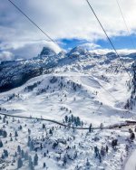
Monday, April 1: The skies were still cloudy but finally starting to clear, and there was zero snow in Cortina proper; it was all at elevation. Too much warm air was able to infiltrate the storm from the south. I estimated the storm snow line was likely at 1500-1600m

Tofana (Red Square) would have to wait for another visit since over 50% of the terrain was below the snow line, and the summit was still in the clouds. Lindsay Vonn's favorite downhill is at Cortina, but Tofana's Olympic/World Cup course would not be great with an inch of rain/liquid on its lower half. A bit of a tough call, but - Pass!


Cortina 3 areas.png


Therefore, Cinque Torri-Lagazuoi was the obvious choice—it is high on a mountain pass with all terrain over 1800m. Plus, it is home to the Armentarola piste, some amazing Refugios, and easy-to-access off-piste terrain. It was also on the way to my next lodging base, Arabba.
cinquetorritrailmap.jpg


The Armentarola piste is one of the most unique in the Alps - starting from the summit of the Lagazuoi cable car, diving off the backside for 8km, and ending a horse-drawn sleigh egress to cabs or Alta Badia lifts.

The Armentarola piste is one of the most famous and appreciated ski slopes in the Alps. It is located right in the center of the Dolomites. The spectacular descent starts on Mt. Lagazuoi and ends at the Capanna Alpina Refuge, unfolding in a unique, majestic setting. At the end of the track, skiers are pulled by horse-drawn carriage to the Sarè bridge to enter the skiable area of Alta Badia. The route is 8.5 km long and unfolds through the pristine Dolomite landscape of the Fanes-Sennes-Prags Nature Park along the rock walls of Mount Cima Scotoni, the Fanis group, and the majestic Piz dles Countries. It's a trip on skis in a fairytale world. Along the way, you can see magnificent centuries-old stone pines (Pinus cembra), the valley of the Scotoni hut with its grill specialties, the icefalls, the restaurant Capanna Alpina, and to top it off, the skiers are pulled through the snow by a horse-drawn tow. It is a very varied and scenic slope, gentle and fascinating from the start at an altitude of 2730 m at the top station of the cable car Lagazuoi down to the 1660 m of the bridge Sarè, where you should ski down unhurried and enjoy every panoramic view. This slope is also part of the Great War Ski Tour and Super8 Ski Tour.


armentarolamap.jpg


There is also a defined 'tour' of the resorts called the Super 8 Link However, the ski area is not large, and one would cover most of these areas over the course of a typical ski day.

The Super8 Ski Tour winds its way around the mountains in the shape of an 8, offering breathtaking views of the most famous Dolomite peaks, such as the Tofana, Pelmo, Civetta, Marmolada, Fanes, Averau, 5 Torri and Conturines. It crosses the Dolomites' three most fascinating mountain passes: Forcella Averau, Croda Negra, and Lagazuoi. Along the foot of the magical Fanes highland, the Armentarola piste unfolds with its steep frozen icefalls. A highlight is the last part of the tour, where skiers are pulled through the snow by a horse-drawn tow. In addition, this ski route offers refreshment in some of the most renowned mountain refuges in the Dolomites.

431470380_804334535062133_8425866189463738797_n.jpg


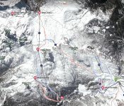
I prefer a more accurate Fatmap of the Cinque Torri - Lagazuoi sector to get a better understanding of the ski area layout (north-facing):

5Torri - Lagazuoi FATMAP.png


I parked and started the day at Lagazuoi Cable Car, but I decided to ski the Cinque Torri side first for easy powder and wait until the skies cleared.

First runs near the 5 Torri rock formation - about 8-16" of new snow depending upon aspect.

15.jpg


15.7.jpg


Luckily, clouds started burning off pretty rapidly, and the sun appeared for the first time in nearly 48 hours.

Espresso stop at Rifugio Averau.

20.jpg


Easy access to off-piste powder from the Averau lift.

16.jpg


21.jpg


23.jpg


1.jpg


22.jpg


After lunch at Rifugio Averau, it was time to head over to Lagazuoi.

Lagazuoi Cable Car - south-facing view over to Cinque Torri sector. Lots of easy access lower angle powder off Col Gallina lifts.

35.jpg


Reference Map
Screenshot 2024-05-11 085835.jpg


Summit of Lagazuoi 2,835m (9,301 ft):

View South to Cinque Torri and Col Gallina
31.jpg


View West to Arabba & Alta Badia
32.jpg

34.jpg


View East to Cortina
33.jpg


Hidden Valley Run to Armenterola
13.jpg


To be continued
 

Attachments

  • 35.jpg
    35.jpg
    323.6 KB · Views: 113
  • 20.jpg
    20.jpg
    117.7 KB · Views: 126
  • Screenshot 2024-05-12 085603.png
    Screenshot 2024-05-12 085603.png
    1.7 MB · Views: 118
Last edited:
Some articles I came across regarding the Dolomites:
  • Why an Italian ski trip offers the best value for money Link
  • How to choose the best Dolomites ski resort for you Link
 
ChrisC got a more comprehensive view of Cinque Torii-Lagazuoi-Falzarego than we did. We were trying to cover more ground on the
World War I tour, and we also chose that itinerary on our sketchiest weather day. That meant the two Averau lifts were closed for wind and we had to take a bus from Bai de Dones to Falzarego. We barely got on the last Falzarego tram and the horselift was closed when we got to Armentarola.

The "How to choose the best Dolomites ski resort for you" link omits Arabba, where we stayed and which we still think has the best logistics. For future reference I'm tempted by the gourmet reputation of Alta Badia.
It [Falzarego] was also on the way to my next lodging base, Arabba.
Still a good hour from what I recall of those roads. You can get there as fast via skis and horselift I suspect.
Tofana's Olympic/World Cup course would not be great with an inch of rain/liquid on its lower half. A bit of a tough call, but - Pass!
We skied Tofana under marginal late season conditions in 2022, but I'm quite confident ChrisC found the ski offerings out of Arraba far superior.
 
Last edited:
You scored nicely with the snow. I would think April powder days are pretty few and far between in that location.
 
I would think April powder days are pretty few and far between in that location.
I do not have much monthly data for the Alps, but average snowfall is quite even by month at sufficient altitude. Recall what we got in April 2018 in Val d'Isere! I vaguely recall ChrisC hypothesizing that big dumps in the Dolomites might be more likely early and late season vs. midwinter.
 
I do not have much monthly data for the Alps, but average snowfall is quite even by month at sufficient altitude. Recall what we got in April 2018 in Val d'Isere! I vaguely recall ChrisC hypothesizing that big dumps in the Dolomites might be more likely early and late season vs. midwinter.
I understand that snow in the Alps is common in April but I’ve generally been lead to believe the Dolomites receives significantly less snow that other areas. I have no data on that but the fact it is so piste focused must give a clue to snow regularity if not total snowfall.
 
Excellent report. At what point did you pull the trigger on booking flights and where did you fly into? Innsbruck and Venice seem to be equidistant to the region, while Milan is a sizable schlep.

As always, I'm fascinated by the region's WWI history and subsequent annexation by Italy.
 
I vaguely recall ChrisC hypothesizing that big dumps in the Dolomites might be more likely early and late season vs. midwinter

This primarily came from reading the WePowder Guide's Weather and Snowfall sections for Monterosa, Zermatt, and the Dolomites. When I have time, I'll post some sections with exact wording.

But generally, I recall that they hypothesized larger dumps come at the beginning and end of winters, with smaller storms and cold in mid-winter. Again, these are generalities.
 
Excellent report. At what point did you pull the trigger on booking flights and where did you fly into? Innsbruck and Venice seem to be equidistant to the region, while Milan is a sizable schlep.

I was supposed to be in Telluride for the entire week, but I decided to limit my stay to Telluride's Closing Weekend and add Italy. I made this decision about 7-10 days beforehand.

The original plan was Milan and 4 days at Monterosa - all relatively easy. However, most of Monterosa would be closed for much of Easter - with heavy snow, rain to 2000m, and wind. Best avoided.

Therefore, given the last-minute nature and the requirement to get from Venice to Montrose, CO, in one day (9am to 8pm/19 hours), I used frequent flier miles.

I acted on this opportunity because the Dolomites just do not get snow, and this was also a bucket list destination (more so than parts of Austria for me).

I don't know how accurate OnTheSnow is, but the table below might be worthwhile for a relative comparison of snow years. There are very few good ones.

1715623315055.png
 
Last edited:
As always, I'm fascinated by the region's WWI history and subsequent annexation by Italy.

I really appreciated this aspect of the Dolomites—its history. Italy almost had no business annexing Sud Tirol; there is very little commonality in language and culture—only colocation near Italy.

Unfortunately, I could not ski the entire WW1 Tour (well - yes, for the Arraba-Marmolada & Cinque Torri sections, but not for Civetta and Alta Badia sections) or linger at many sites/museums.

Some areas of interest:
  • Cinque Tori Front Link
  • The Great War Ski Tour Link
  • World War 1 Museum Link
 
Last edited:
Italy almost had no business annexing Sud Tirol; there is very little commonality in language and culture—only colocation near Italy.
I've mentioned before that it's always interesting to read trip reports on Alpinforum, where a) they generally use the original German place names, but b) never convey any "give Südtirol back to Austria!" sentiments. Maybe because the annexation happened 100+ years ago and is considered ancient history. I wonder how much annual tourism revenue the region generates?
 
I've mentioned before that it's always interesting to read trip reports on Alpinforum, where a) they generally use the original German place names, but b) never convey any "give Südtirol back to Austria!" sentiments. Maybe because the annexation happened 100+ years ago and is considered ancient history. I wonder how much annual tourism revenue the region generates?

Mussolini helped forced assimilation:

Italianization of South Tyrol Link

However, South Tyrol might have had the last 'laugh'? Link

The province is granted a considerable level of self-government, consisting of an extensive range of exclusive legislative and executive powers and a fiscal regime that allows it to retain 90% of revenue while remaining a net contributor to the national budget. As of 2016, South Tyrol is the wealthiest province in Italy and among the wealthiest in the European Union.​
(If only California or New York kept their federal taxes versus a diversion to AL/MS/KY/AR/etc.)​
Instead of going the route of Northern Ireland in the 1970s - or the Basque & Catalonia

Relations between the German and Italian speakers eventually improved in the 1970s when South Tyrol was granted autonomy. Under the agreement, 90% of taxes paid here stay here.​


Tourism. Given the infrastructure of rifugios (eating/drinking/overnights) for hiking, climbing, via ferratas, biking, etc., I assume the Dolomites are even busier in the summer.

It is the richest Italian province because of excellent climate that favours agriculture – with up to 300 sunny days a year – and a flourishing tourism industry. South Tyrol is visited by around 6 million people a year, which is the same number of tourists who visit Brazil every year. This makes the region wealthy, but also creates difficulties for local people who have to deal with extreme traffic and crowded cities as well as polluted nature.​
 
If you get a chance to check out the town of Bolzano (Bozen in German) just to the west of the Dolomites do so. The architecture is clearly Austrian but the culture a nice mix of both Austrian and German. And the museum with Otzi the Iceman as main exhibit is fascinating.
 
Tuesday, April 2: Sass Pordoi and the Sella Massif. Now based in Arabba, I met our guide, Francesco (and three other UK guys), at 8 a.m. at the Paso Pordoi Cable Car. We planned to ski as many couloirs as time would allow before ending the day with the Val Mesdi (or Val di Mezdi), the 'Vallee Blanche' of the Dolomites. With 10-20 inches of new snow, sun, a good crew, and little wind, it does not get much better!

Importantly, I highly recommend the guide's book "Freeriding in the Dolomites"—it has excellent photography and route descriptions. It's one of the best freeride books out there—if not the best—and I have purchased the equivalents for Verbier, St. Anton/Arlberg, Davos, Mount Blanc (Chamonix/Courmayeur), Tignes, Val d'Isere, and La Grave.
Link

FreerideInDolomiti_ENG.jpg


An excerpt from the book detailing the numerous couloirs (or canales) available from the Sella Massif and the Paso Pordoi Cable Car.


Freeriding the Dolomites.png


Sass Pordoi Cable Car

The Sass Pordoi cable car is one of the ski world's best lifts: Passo Pordoi (2239 m) to Sass Pordoi (2950 m) for a total of 2,400 vertical ft. Where else does a relatively unused cable car serve about 20+ exceptional itineraries (narrow couloirs, wide couloirs, and big open valleys)?

Sass Pordoï: The Best Ski Lift in the Dolomites

3.jpg


4.jpg


Forcella Pordoi (or Saas Pordoi South Face)

This notch run is named after the Refugio Forcella Pordoi, which sits directly above the itinerary. It faces due south, so get there early, like we did. It was a bit of a tryout route, showing the guide that everyone could ski at a high level. It is easy to lap. I would not categorize it as 'severe' like Fatmaps since it is quite wide and quickly spills out onto an open face/meadow.

Ride the cable car up to Sass Pordoi and then ski northeast away from the station before swinging around to the southeast and dropping down to a small col that looks down on this line's initial couloir. Take a final look at conditions; it would be a pain—but possible—to hike back to the cable car station from here if you didn't think the line looked safe.
If all looks well, drop down into the couloir and enjoy the tight, technical turns you'll make between 2 towering Dolomitic rock walls. The couloir opens up pretty quickly and gives way to a huge, open face. There are almost limitless options for skiing the face, so pick the best line! The line drawn here is one of the main ways down, but there's also the option to go skier's left of the large rock buttress you encounter halfway down the face. Alternatively, you could go hard skier's left as soon as you leave the entrance couloir and ski the eastern part of the face, which would deposit you back at the Saletei chairlift. From here, it's a quick ride back up to Sass Pordoi, followed by a 5-minute walk back to the cable car itself. Whichever line you choose, the skiing is fast and furious! If conditions are still good, head up for another lap or a trip down the legendary Val Lesties, north of the top cable car station.

Fatmap Saas Pordoi.png


50.jpg


Couloir Joel

This is one of my favorite couloirs! It starts with an open funnel and then descends into a constricted choke point with beautiful limestone walls, leading to open meadows. The only negative is its southern exposure, so one needs to time it more carefully in the Spring.

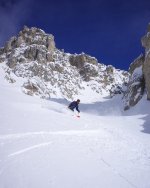
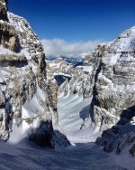
Take the Sass Pordoi cable car up. Ski down towards Rifugio Forcella Pordoi. After the hut, traverse E/NE and stay at the same height for about 150-200m. Stop and hike straight up S/SW. It's clear where to hike up, between the rocks. The ascent is max 35° steep and around 100m to the ridge. From the ridge, you can ski down in the beautiful couloir. The couloir starts out with a wide funnel, not that steep. It gets up to 45° steep and around 3m wide, depending on how much snow is built up. The most narrow part is between steep and high rock walls. After that, the line opens up again, and you can ski down the open field towards the cable car. Be aware of the rocks in the open field. Enjoy this beautiful and easily accessible classic Dolomiti Canale!

Fatmap Joel Couloir.png


20.jpg


22.jpg


21.jpg


Val Lasties

A semi-narrow couloir quickly opens up into a beautiful basin.

Start by riding the gondola up to Sass Pordoi and skiing northeast to the col, which marks the point at which this route splits from the other tours in the area. Ski down the fabulous gully that lies immediately north-northeast of the col. The gully is pure fun and features no nasty surprises, just brilliant terrain and (usually) excellent snow, too.
The gully widens into a spectacular valley, which can be skied just about anywhere. Follow it as it swings around gradually to the left. As it begins to steepen and trees begin appearing, push out the skier's left to a gully, which is reminiscent of the initial gully at the very start of the route. Ski down this to nicely spaced trees below. Blast through these drifting left all the way to reach a road. Cross this and continue skiing down to the Pain Frataces - Gherdecia gondola. Take this up and ride it to get back into the Super Ski Dolomiti lift network.

Fatmap Val Lasties.png


6.jpg
7.jpg


Val Mezdi Link

It's just an amazing line and perhaps the classic descent of the Dolomites. After an initial slightly steep and tight entry, it really opens up into a giant valley. It's perhaps the easiest itinerary off the Sella Massif but more difficult than the Vallee Blanche - advanced intermediate and above. The most difficult part is traversing across the Sella plateau to its entry.

Start by riding the cable car ride to the top of the Sass Pordoi at 2,950m. If you have time, grab a coffee and soak up the view before skirting around the hillside in an easterly direction. Leave the ascent to the 3,152m Piz Boé on your right and continue toward the Rifuigio Boe located at the Col Turond at 2,873m. The proper ski descent starts here, and getting to this point involves a little over 100 meters of ascent, so there is very little effort required to access this line relative to how fun it is to ski.
From the Refugio, descend north-northeast into the Mezdi Valley. The initial drop is quite steep, but things mellow out quickly, and most of the descent is fast and flowy. There is minimal route finding, and it's impossible to exit the valley accidentally, so roam around looking for the best snow and terrain. The ambiance of the valley is extraordinary, and this line is perfect for those who want to experience a typical Dolomites couloir but don't want to do any steep skiing.
When the valley begins to widen up, drift out skier's right to locate the exit gully. The gully is wide and great to ski so the fun is not over just because you've finished the main valley. Once out of the gully, ski down through a short section of fun trees and cross an almost flat plateau to reach the foot of the Plans gondola.

Fatmap Val Meszdi.png


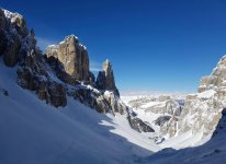
Afternoon sun on Val Mezdi entrance - it faces almost due north (and when combined with elevation), snow preservation is perhaps the best in the Dolomites.

34.jpg

57.jpg

58.jpg


It was definitely a top-five day in the Alps! We did not finish until almost 5 p.m., ending in Corvara, where the guide is based. After some celebratory beers, I took a cab back to Arabba since it looked like I missed the last reasonable bus home.
 

Attachments

  • 7.jpg
    7.jpg
    276.7 KB · Views: 108
  • 34.jpg
    34.jpg
    295.2 KB · Views: 105
  • 6.jpg
    6.jpg
    376.2 KB · Views: 104
  • 44.jpg
    44.jpg
    280.8 KB · Views: 105
  • 50.jpg
    50.jpg
    97.8 KB · Views: 105
Last edited:
I liked this video of the Joel Couloir.

The Dolomites' couloirs/canales are as good as anything at La Grave or Verbier - likely better than Andermatt, Val d'Isere, St. Anton. However, they do not get nearly the press. That's fine; who wants competition?

I thought I wanted to return to La Grave one day to ski some of the lines I missed. Probably not; I would rather play around in the Dolomites for 10 days during a good snow year.

 
Back
Top