~6 mile skin/climb to get there. lot's of windpacked snow while touring
in........even in the trees. winds blowing strong! temps in the 20's i believe.
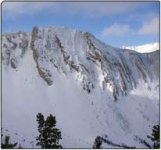
so we approached the basin at noon, looking across the way
(like what you see in the picture, but better and a whole lot bigger).
we didn't expect there to be enough coverage, but it sure did look like it
so we headed down and over and up, and hoped that the snow wasn't as
windslabbed as it was on our tour in. that took two hours to do.
yep, just to get over to the other side. it was worth it though.
the snow is pretty well protected by some enormous rocks so our run
wasn't windloaded at all. still a little boney though. i did skim a few rocks
on my way down. 3'-4' deep. 6" of creme ontop. we rode down the part
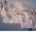
that doglegs left(skiers left) about halfway down the run. it's about a 35
degree slope on average. not as gnar as when you look across the way,
but still pretty dangerous. if it slide while riding the top part, you go over
those cliffs. gotta pick your days right at lines like this one. MODERATE
on recently windloaded, and LOW everywhere else was the advisory for this day.
this is the only run we took, but LOOK at it. :shock:
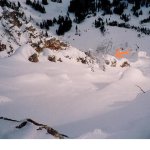
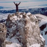
here's a winter pic not from yesterday(still in my disposable camera), but
just to give you an idea, here's one from a previous winter with less
coverage than what we found yesterday.


