schubwa
New member
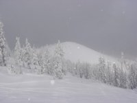
It was a pretty good set-up with 11" falling Monday with whiteout conditions in the PM. Add 6"+ overnight, with good visibilities = epic conditions. I rode my "Big Red" 168 Santa Cruz that's as wide as an aircraft carrier, and I needed every inch of floatation! Very high quality snow and at least knee deep with lots o' shots.
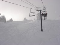
The area improved their snow/weather site, which reported a 61/75" base this morning (11/29) with 119" for the season so far. We're hoping for the Summit chair to open this Friday.
I rode with a skier couple from Alpine Meadows and they were stoked as season pass holders there get free passes here (Powdr Corp). We're hoping for lots of Sierra snow otherwise this X-mas is bound to be crowded.
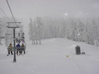