Ice Axe Expeditions, with whom I'll be doing the Antarctic cruise in November, recommended a training session for alpine touring. They referred me to Alpine Skills International for a 3-day trip on Mt. Shasta similar to this: http://www.alpineskills.com/spring_hiddenvalley.html. 5 of us on the cruise signed up for the weekend of June 17-19. Lauren, James and Kelly are Tahoe locals in their 30's, and Terry (53) lives in SF but is a serious road biker and weekend Squaw skier, so it's obvious who was going to be the weak link in the challenge of summitting 14,162 foot Mt. Shasta. Our guide Ben Mitchell is one of only 60 American mountain guides with IFMGA certification. I arrived in the town of Mt. Shasta Thursday evening. Here's the view of Mt. Shasta from the town of McCloud to the south.

We met at a mountain shop Friday morning for Ben to review our gear. I was sent to another shop to buy a synthetic T-shirt, shell pants and ski crampons. We drove to the Bunny Flat trailhead at 6,950 feet and began skinning up at noon. Friday was warm and clear so the snow was soft and I wore a cotton T-shirt and the new shell ventilated to stay as cool as possible. Here's our group on one of 3 rest stops about halfway to our camp about 3PM.

The 5 hour climb to camp with a full pack was very strenuous for me, especially when a ski slipped in the soft snow. When climbing I had to concentrate on rolling my knees to the downhill side to maintain maximum skin contact, as opposed to the skiing instinct to roll the knees uphill to put the skis on edge. The good news was that the snow was smooth with virtually no suncupping above 8,500 feet.
The camp was in Hidden Valley at about 9,200 feet. For the last stretch the rest of the group moved quickly to start setting up camp.

Shasta's West Face rises 4,000 feet above camp.
From the same spot here's a view of the secondary peak Shastina at 12,200 feet.

Here's where Ben set up camping stoves to melt snow for refilling water and for our dinners and breakfasts.

We also tried on our boot crampons, dried our skins and discussed plans for the next 2 days. The original plan was to spend Saturday training and doing some skiing on Shastina, then rise very early Sunday to summit Shasta. But the forecast called for deteriorating weather starting Saturday afternoon, so Ben changed plans to attempt the summit Saturday.
8:30 sunset pics from Hidden Valley.


On Saturday Ben got us up at 3AM for breakfast and we started skinning up shortly after 4AM. Here I am at 5AM, occasionally in front so Ben could keep me going at a steady and appropriate pace.

Around this time the slope got a bit steeper, so with the firm snow we put on ski crampons. They were very helpful in making my climbing more secure, and I never slipped while using them. We had a rest stop at 6AM at 10,200 feet and had this view of Mt. Shasta shading the valley below.

By 7:15AM at 11,000 feet the slope was still steeper, James was occasionally slipping so Ben decided we needed to put the skis on our packs and climb with boot crampons and an ice axe.

Climbing in boot crampons about 8AM

Rest stop at 11,700 feet 8:50AM with climbers below.

The view down looks good but there's already a cloud on Shastina.

Our next stop was at 12,500 feet at 10:15AM. The wind was now picking up from the NW so we crossed south into the top of Avalanche Gulch to mitigate it. Looking back to the West Face we saw our first skier coming down.

Ben had instructed us well on climbing in boot crampons and I was generally comfortable even though I had only worn them before on precut ice steps on the Franz Josef Glacier in New Zealand last July. However the wind made it slow going for me for me with a top heavy pack with skis on it. For the last ~150 feet (probably only 20 vertical climb) we had to cross back onto the West Face with wind much stronger, blowing snow impeding visibility, so Ben had to come and get my pack for that part. I collapsed slightly dizzy on the top of the West Face at 13,200 feet, and Ben was immediately on my case, making sure I was drinking and eating while he got my boot crampons and skins off and bindings set to ski mode.
In the deteriorating weather there was no question about going any higher so we got set up to ski down by 12:15PM.


This turned out for the best in terms of snow conditions. I skied very defensively since my legs were worked from the climb, but when I dropped in I was pleasantly surprised that the snow at 13,000+ was only moderately firm. Skiing demanded my full concentration under the circumstances so I didn't even think about getting the camera out. Fortunately Ben took lots of ski pictures. Here we are on the upper West Face.

About 500 feet down the snow had softened to nearly perfect corn, where it remained for another 2,500. Ben set up for pics in the sweet spot. Lauren:


James:

Me:


Terry:

Kelly:

The snow got heavy abruptly about 1,000 feet above camp. But the terrain was mostly moderate there so it worked fine with wide gradual turns. We were back in camp at 1:05PM. Looking back up the cloud is just on the top part of what we skied.

I started to cool off fast so I got in my sleeping bag for a couple of hours. The weather got worse, so Ben put off doing any more teaching until Sunday and fixed dinner by 6PM. We're eating here, and note the cloud is now only ~1,000 feet above camp.

Ben had us build snow walls around our tents to mitigate the wind. The view down is different from Friday too.

We went to bed shortly after dinner as the wind was picking up. It blew hard most of the night. Ben got us up at 6AM and told us to pack up. It was clear now but blowing ~30MPH with gusts to 50. About 3AM one of our tent poles broke and punctured 2 small holes in the ceiling.

Fortunately no precipitation with that wind.
Taking down the tents had to be done carefully in the wind. We finally headed down on skis at 7:30AM with full packs over bulletproof snow. Fortunately once we got past the first corner the wind was not so strong. Snow began to soften in the sun just above 8,000 feet. We stopped for a break at Horse Camp at 7,900.
This cabin has pit toilets and a spring to refill water, but the cabin is still buried nearly to the roof.

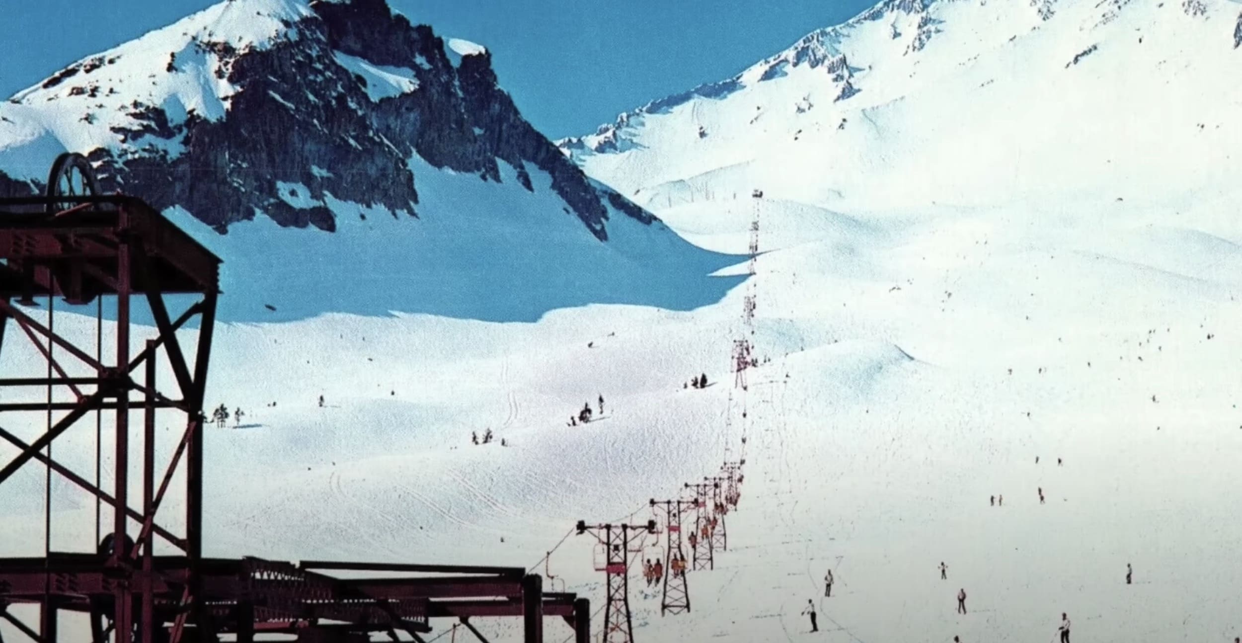
We were back to the trailhead at Bunny Flat by 9AM. We drove into town for a hearty breakfast at Black Bear Cafe. At noon we went back up to Bunny Flats because Ben wanted to teach us about glacier travel we will have in Antarctica. Most of the time was spent on building snow anchors, which we customers must do if a lead guide falls into a crevasse. Testing a snow anchor here:

And here James attaches the rope to the snow anchor he built. Avalanche Gulch (popular summer climbing route on SW Face) in background.

Ben then instructed us on potential roped travel across glaciers, and we finally wrapped up about 3:30PM Sunday.
Topo map with Friday/Sunday route and Saturday climbing route in black and ski path on West Face to camp in red.

Horse Camp is near the bottom of the map but Bunny Flat is just off the map.
Shasta and Shastina viewed from town with West Face ski route to Hidden Valley in red.

This trip was the true "Warren Miller experience" (if you don't do it this year...) of my first year of retirement, not likely to be repeated. It was surely more rigorous than anything I will do on that cruise, which is at sea level and where I get to sleep in my cabin every night with real bathrooms and nice meals every day.
But this trip did set a couple of personal milestones: Highest elevation on skis at 13,200 and 6,200 of backcountry earned turns. With a guide getting us up early and keeping me moving we did hit the optimal window for corn snow on Saturday. I'm sure some on the trip were disappointed that weather kept us off the summit, but I've read reports that the very top terrain is usually wind hammered and not that great for skiing. For the backcountry aficionados like icelantic, Mt. Shasta should definitely be on the short list.
We met at a mountain shop Friday morning for Ben to review our gear. I was sent to another shop to buy a synthetic T-shirt, shell pants and ski crampons. We drove to the Bunny Flat trailhead at 6,950 feet and began skinning up at noon. Friday was warm and clear so the snow was soft and I wore a cotton T-shirt and the new shell ventilated to stay as cool as possible. Here's our group on one of 3 rest stops about halfway to our camp about 3PM.
The 5 hour climb to camp with a full pack was very strenuous for me, especially when a ski slipped in the soft snow. When climbing I had to concentrate on rolling my knees to the downhill side to maintain maximum skin contact, as opposed to the skiing instinct to roll the knees uphill to put the skis on edge. The good news was that the snow was smooth with virtually no suncupping above 8,500 feet.
The camp was in Hidden Valley at about 9,200 feet. For the last stretch the rest of the group moved quickly to start setting up camp.
Shasta's West Face rises 4,000 feet above camp.
From the same spot here's a view of the secondary peak Shastina at 12,200 feet.
Here's where Ben set up camping stoves to melt snow for refilling water and for our dinners and breakfasts.
We also tried on our boot crampons, dried our skins and discussed plans for the next 2 days. The original plan was to spend Saturday training and doing some skiing on Shastina, then rise very early Sunday to summit Shasta. But the forecast called for deteriorating weather starting Saturday afternoon, so Ben changed plans to attempt the summit Saturday.
8:30 sunset pics from Hidden Valley.
On Saturday Ben got us up at 3AM for breakfast and we started skinning up shortly after 4AM. Here I am at 5AM, occasionally in front so Ben could keep me going at a steady and appropriate pace.
Around this time the slope got a bit steeper, so with the firm snow we put on ski crampons. They were very helpful in making my climbing more secure, and I never slipped while using them. We had a rest stop at 6AM at 10,200 feet and had this view of Mt. Shasta shading the valley below.
By 7:15AM at 11,000 feet the slope was still steeper, James was occasionally slipping so Ben decided we needed to put the skis on our packs and climb with boot crampons and an ice axe.
Climbing in boot crampons about 8AM
Rest stop at 11,700 feet 8:50AM with climbers below.
The view down looks good but there's already a cloud on Shastina.
Our next stop was at 12,500 feet at 10:15AM. The wind was now picking up from the NW so we crossed south into the top of Avalanche Gulch to mitigate it. Looking back to the West Face we saw our first skier coming down.
Ben had instructed us well on climbing in boot crampons and I was generally comfortable even though I had only worn them before on precut ice steps on the Franz Josef Glacier in New Zealand last July. However the wind made it slow going for me for me with a top heavy pack with skis on it. For the last ~150 feet (probably only 20 vertical climb) we had to cross back onto the West Face with wind much stronger, blowing snow impeding visibility, so Ben had to come and get my pack for that part. I collapsed slightly dizzy on the top of the West Face at 13,200 feet, and Ben was immediately on my case, making sure I was drinking and eating while he got my boot crampons and skins off and bindings set to ski mode.
In the deteriorating weather there was no question about going any higher so we got set up to ski down by 12:15PM.
This turned out for the best in terms of snow conditions. I skied very defensively since my legs were worked from the climb, but when I dropped in I was pleasantly surprised that the snow at 13,000+ was only moderately firm. Skiing demanded my full concentration under the circumstances so I didn't even think about getting the camera out. Fortunately Ben took lots of ski pictures. Here we are on the upper West Face.
About 500 feet down the snow had softened to nearly perfect corn, where it remained for another 2,500. Ben set up for pics in the sweet spot. Lauren:
James:
Me:
Terry:
Kelly:
The snow got heavy abruptly about 1,000 feet above camp. But the terrain was mostly moderate there so it worked fine with wide gradual turns. We were back in camp at 1:05PM. Looking back up the cloud is just on the top part of what we skied.
I started to cool off fast so I got in my sleeping bag for a couple of hours. The weather got worse, so Ben put off doing any more teaching until Sunday and fixed dinner by 6PM. We're eating here, and note the cloud is now only ~1,000 feet above camp.
Ben had us build snow walls around our tents to mitigate the wind. The view down is different from Friday too.
We went to bed shortly after dinner as the wind was picking up. It blew hard most of the night. Ben got us up at 6AM and told us to pack up. It was clear now but blowing ~30MPH with gusts to 50. About 3AM one of our tent poles broke and punctured 2 small holes in the ceiling.
Fortunately no precipitation with that wind.
Taking down the tents had to be done carefully in the wind. We finally headed down on skis at 7:30AM with full packs over bulletproof snow. Fortunately once we got past the first corner the wind was not so strong. Snow began to soften in the sun just above 8,000 feet. We stopped for a break at Horse Camp at 7,900.
This cabin has pit toilets and a spring to refill water, but the cabin is still buried nearly to the roof.
We were back to the trailhead at Bunny Flat by 9AM. We drove into town for a hearty breakfast at Black Bear Cafe. At noon we went back up to Bunny Flats because Ben wanted to teach us about glacier travel we will have in Antarctica. Most of the time was spent on building snow anchors, which we customers must do if a lead guide falls into a crevasse. Testing a snow anchor here:
And here James attaches the rope to the snow anchor he built. Avalanche Gulch (popular summer climbing route on SW Face) in background.
Ben then instructed us on potential roped travel across glaciers, and we finally wrapped up about 3:30PM Sunday.
Topo map with Friday/Sunday route and Saturday climbing route in black and ski path on West Face to camp in red.
Horse Camp is near the bottom of the map but Bunny Flat is just off the map.
Shasta and Shastina viewed from town with West Face ski route to Hidden Valley in red.
This trip was the true "Warren Miller experience" (if you don't do it this year...) of my first year of retirement, not likely to be repeated. It was surely more rigorous than anything I will do on that cruise, which is at sea level and where I get to sleep in my cabin every night with real bathrooms and nice meals every day.
But this trip did set a couple of personal milestones: Highest elevation on skis at 13,200 and 6,200 of backcountry earned turns. With a guide getting us up early and keeping me moving we did hit the optimal window for corn snow on Saturday. I'm sure some on the trip were disappointed that weather kept us off the summit, but I've read reports that the very top terrain is usually wind hammered and not that great for skiing. For the backcountry aficionados like icelantic, Mt. Shasta should definitely be on the short list.

")

 /
/