Folks here may remember conversations discussing the San Rafael Swell, a 20,000 square-mile desert region in east-central Utah. This weekend I decided to forego skiing in favor of a desert trip to visit the southern part of the Swell, and in particular the San Rafael Reef. These are trips best done in the spring and in the fall, and I wanted to get a desert trip in before it gets too hot to enjoy down there.
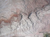
Those who have driven I-70 west from Green River have seen the Reef:

The Reef is a gigantic limestone uplift that runs for 40 miles and forms the eastern and southern end of the San Rafael Swell.

It's a wonder of myriad topographies all compressed within a short distance, perfect for a backpack. The plans were first drawn out on a topo map, and I had settled upon Eardley Canyon before finding out at the last minute, courtesy Marc_C, that Eardley is a rather technical slot requiring five rappels. Short on time Friday night, we had to settle upon something quickly and decided upon Little Wild Horse Canyon and Bell Canyon, near the southern end of the Reef north of Hanksville.
Tcope and I headed south around 8 a.m. Saturday morning. Skidog was supposed to go as well but had to cancel at the last minute. Going was slow as we paused often to gape at the landscape and snap photos.


The Utah desert may seem foreign to those who have only seen the ski runs in the Wasatch, but the state is a wonder of various climates. Those unfamiliar with the desert may assume that it's a barren, forbidding landscape, but it's home to all sorts of flora and fauna:


We also saw bats, hummingbirds, ravens and more that make their home in the harsh desert landscape. Stop for a moment, look around, and you suddenly realize that the desert is teeming with life.
It was nearly noon by the time we reached our destination...

...put on our boots, shouldered our pack and headed into Little Wild Horse Canyon (LWH). To be honest, LWH is the most popular hike in the Swell and was way too busy for my liking. It's a non-technical slot canyon which draws scores of adults, kids, dogs and the like. Add a beautiful Saturday in May, and it frankly was a zoo.
The canyon quickly narrows into a deep slot that extends for more than two miles of its four-mile overall length.


A good chunk in the middle was still wet, which turned many around.


Those who didn't turn back took off their shoes, but we managed to stay dry by employing some handy bouldering techniques.
By the time we got above the slot, we were nearly by ourselves, encountering only a handful of parties thereafter. After a couple of challenges to negotiate...

...we reached the top of LWH and worked our way northwest, west, and eventually southwest, first along the dry wash itself and then on a trail that led to an old uranium mining road.

Honestly, the scenery in here was nothing short of stunning, with the blue sky juxtaposed against the tan, red and grey rock, and green bushes.

We paused for a while to check out some mine ruins near the head of Bell Canyon, remains of the Cistern Mine -- a uranium prospect from the Cold War days in the 1950s.


We camped against a towering wall right at the head of Bell for the night, a site which we reached after a little over six miles the first day in 4 hours and 45 minutes.

That six miles was slow going working our way through the slot of LWH. We ate dinner (sweet and sour chicken for me, chicken curry with cashews for tcope) before playing a round of spades (I lost). It was deathly quiet as we watched the sunset...

...and a sliver of a moon before calling it a night at 9 p.m.

We awoke at 8:30 a.m. We had obviously been more tired than we had realized. We had to pack in our own water on this trip, and despite some rationing on Saturday night we awoke Sunday with only about 20 oz. left between us. It was enough for my morning coffee, but I passed on the instant oatmeal in favor of an energy bar to conserve four of those ounces. Our trip out was fortunately early in the day and only two miles long, all downhill.


Bell on a Sunday morning was nearly deserted, and we encountered only one party within the canyon itself, and even they were quite low and just heading up. By the time we reached the parking lot, however, far more were arriving.
I had a couple of other sights in the area that I wanted to see for the first time, not the least of which were the formations of Goblin Valley.


Summer is Euro tourist season in Utah, and they've already arrived in droves. Funny, but I overheard as much German as English while in Goblin Valley.

Tcope is a kite enthusiast, and he tried to launch his remote-controlled camera rig to get some aerial photos of Goblin Valley, but alas, the wind was too inconsistent.

While Todd packed things up I wandered over to Carmel Canyon.

We then headed north toward Uneva Mine Canyon. This is another narrow cleft in the San Rafael Reef, but one that still has the remains of an open mine adit.

I've been able to find precious little in the way of history of the Uneva Mine, but I have found evidence from the decade 1880-1890, which leads me to believe that it was a gold or copper prospect.
In contrast to the crowds at LWH, we didn't see a single vehicle after turning off UT-24 and working our way west and north along dirt roads to the mouth of the canyon. In fact, when we arrived at the parking area simply marked "Trailhead," we were the only vehicle.

"Trailhead," however, is a misnomer as there is no trail. Getting into Uneva Mine Canyon involves a great deal of boulder hopping, tamarisk avoidance, and navigating other obstacles.

It's fortunately a mere three quarters of a mile from the trailhead to the mine entrance.

You've really got to wonder what made a guy look at one solid slab of rock in particular, and say, "I think we should start tunneling here."
We turned on our headlamps and wandered in.

We admittedly didn't go very far, for a) it doesn't look terribly stable, and b) we encountered a significant roadblock only a short distance in.

Still, it made for a marvelous adventure which we were still talking about en route back to the truck, even as we passed scattered bones, a reminder of what a harsh and forbidding place the desert can be.

We also took in the La Sal Mountains southeast of Moab far in the distance.

A quick stop at Groggs, a brewpub in Price, for a bite to eat (great burgers and decent steamed clams, believe it or not) and a well-earned ice cold beer (pretty good, too, although apparently brewed off-site), and we got back on US-6 to return to Salt Lake City.
Whether on skis, in a kayak, by car or on foot, I never get tired of exploring this place!
Those who have driven I-70 west from Green River have seen the Reef:
The Reef is a gigantic limestone uplift that runs for 40 miles and forms the eastern and southern end of the San Rafael Swell.
It's a wonder of myriad topographies all compressed within a short distance, perfect for a backpack. The plans were first drawn out on a topo map, and I had settled upon Eardley Canyon before finding out at the last minute, courtesy Marc_C, that Eardley is a rather technical slot requiring five rappels. Short on time Friday night, we had to settle upon something quickly and decided upon Little Wild Horse Canyon and Bell Canyon, near the southern end of the Reef north of Hanksville.
Tcope and I headed south around 8 a.m. Saturday morning. Skidog was supposed to go as well but had to cancel at the last minute. Going was slow as we paused often to gape at the landscape and snap photos.
The Utah desert may seem foreign to those who have only seen the ski runs in the Wasatch, but the state is a wonder of various climates. Those unfamiliar with the desert may assume that it's a barren, forbidding landscape, but it's home to all sorts of flora and fauna:
We also saw bats, hummingbirds, ravens and more that make their home in the harsh desert landscape. Stop for a moment, look around, and you suddenly realize that the desert is teeming with life.
It was nearly noon by the time we reached our destination...
...put on our boots, shouldered our pack and headed into Little Wild Horse Canyon (LWH). To be honest, LWH is the most popular hike in the Swell and was way too busy for my liking. It's a non-technical slot canyon which draws scores of adults, kids, dogs and the like. Add a beautiful Saturday in May, and it frankly was a zoo.
The canyon quickly narrows into a deep slot that extends for more than two miles of its four-mile overall length.
A good chunk in the middle was still wet, which turned many around.
Those who didn't turn back took off their shoes, but we managed to stay dry by employing some handy bouldering techniques.
By the time we got above the slot, we were nearly by ourselves, encountering only a handful of parties thereafter. After a couple of challenges to negotiate...
...we reached the top of LWH and worked our way northwest, west, and eventually southwest, first along the dry wash itself and then on a trail that led to an old uranium mining road.
Honestly, the scenery in here was nothing short of stunning, with the blue sky juxtaposed against the tan, red and grey rock, and green bushes.
We paused for a while to check out some mine ruins near the head of Bell Canyon, remains of the Cistern Mine -- a uranium prospect from the Cold War days in the 1950s.
We camped against a towering wall right at the head of Bell for the night, a site which we reached after a little over six miles the first day in 4 hours and 45 minutes.
That six miles was slow going working our way through the slot of LWH. We ate dinner (sweet and sour chicken for me, chicken curry with cashews for tcope) before playing a round of spades (I lost). It was deathly quiet as we watched the sunset...
...and a sliver of a moon before calling it a night at 9 p.m.
We awoke at 8:30 a.m. We had obviously been more tired than we had realized. We had to pack in our own water on this trip, and despite some rationing on Saturday night we awoke Sunday with only about 20 oz. left between us. It was enough for my morning coffee, but I passed on the instant oatmeal in favor of an energy bar to conserve four of those ounces. Our trip out was fortunately early in the day and only two miles long, all downhill.
Bell on a Sunday morning was nearly deserted, and we encountered only one party within the canyon itself, and even they were quite low and just heading up. By the time we reached the parking lot, however, far more were arriving.
I had a couple of other sights in the area that I wanted to see for the first time, not the least of which were the formations of Goblin Valley.
Summer is Euro tourist season in Utah, and they've already arrived in droves. Funny, but I overheard as much German as English while in Goblin Valley.
Tcope is a kite enthusiast, and he tried to launch his remote-controlled camera rig to get some aerial photos of Goblin Valley, but alas, the wind was too inconsistent.
While Todd packed things up I wandered over to Carmel Canyon.
We then headed north toward Uneva Mine Canyon. This is another narrow cleft in the San Rafael Reef, but one that still has the remains of an open mine adit.
I've been able to find precious little in the way of history of the Uneva Mine, but I have found evidence from the decade 1880-1890, which leads me to believe that it was a gold or copper prospect.
In contrast to the crowds at LWH, we didn't see a single vehicle after turning off UT-24 and working our way west and north along dirt roads to the mouth of the canyon. In fact, when we arrived at the parking area simply marked "Trailhead," we were the only vehicle.
"Trailhead," however, is a misnomer as there is no trail. Getting into Uneva Mine Canyon involves a great deal of boulder hopping, tamarisk avoidance, and navigating other obstacles.
It's fortunately a mere three quarters of a mile from the trailhead to the mine entrance.
You've really got to wonder what made a guy look at one solid slab of rock in particular, and say, "I think we should start tunneling here."
We turned on our headlamps and wandered in.
We admittedly didn't go very far, for a) it doesn't look terribly stable, and b) we encountered a significant roadblock only a short distance in.
Still, it made for a marvelous adventure which we were still talking about en route back to the truck, even as we passed scattered bones, a reminder of what a harsh and forbidding place the desert can be.
We also took in the La Sal Mountains southeast of Moab far in the distance.
A quick stop at Groggs, a brewpub in Price, for a bite to eat (great burgers and decent steamed clams, believe it or not) and a well-earned ice cold beer (pretty good, too, although apparently brewed off-site), and we got back on US-6 to return to Salt Lake City.
Whether on skis, in a kayak, by car or on foot, I never get tired of exploring this place!

")