Snow Basin, UT 1-2-09

socal

Member
We made it to the parking lot around 9:15 am and were on John Paul Express at 9:30 or so. Place was empty, we were the first people on the tram, and there was never more than 5 people or so on the tram with us at any time. Our first lap we went down the face of the tram area then took a left through a gate and worked our way down. Top of the mountain was nice, soft chalky snow, very much winter snow. By about 1/2 way down the snow got heavy and was pretty ugly (pine needles and branches, wind I assume). Next lap we hiked up No Name peak and it was great, again, until about 1/2 way down. The 2nd half of the runs (don't know the name but we were at the skiers left boundary) were exhausting. After another run or so we headed in for lunch. Wow, very very impressed with the food, facilities, employees, and as mentioned before the bathrooms.

After lunch we made our way over to Strawberry Gondola. The wind was howling up there and much of the way down. On our last ride up at around 3:15 the gondola kept stopping, I assume it was the wind. They told us they were done for the day a little early and we headed back to the base area. I have no idea what trails we were on (should have opened that map once or twice), but we were now at the skiers right boundary. We found pockets of very nice snow and some ice (probably due to the wind blowing the snow off, as it was doing when we were coming down. Scenery was great as was the terrain. Very impressed with the steepness. They could really use about 3-5 more feet to cover up the small tress sticking out everywhere, I imagine that they're all covered in a month or so.

It was interesting that there was a 5 minute or so wait for Needles Gonodla but no lines anywhere else, not one person at the bottom of Strawberry, John Paul, or the tram. Looking for some thoughts on where to go tomorrow. Now looks like Snow Basin has 7.75 inches as of 8:30 and according to the NWS the heavy stuff will come later tonight (only in LLC/BCC?). Given the week between storms I think that LCC will be a mad house. BCC probably less so, but Solitude's terrain really just doesn't compare to what we saw at Snow Basin. Thoughts? Suggestions?

Some pics:

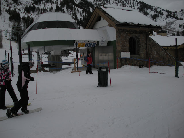
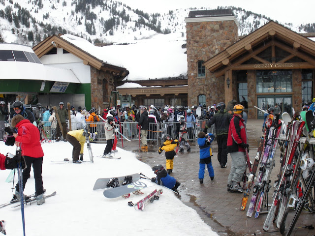
A familiar site all day, this might have been the busiest it was all day:
DSCN0116.JPG


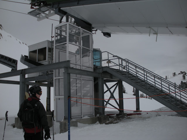
Another familiar site at the Tram:
DSCN0119.JPG


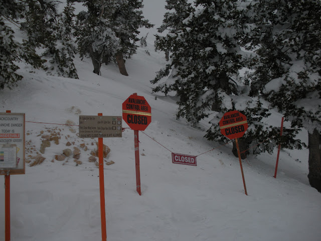
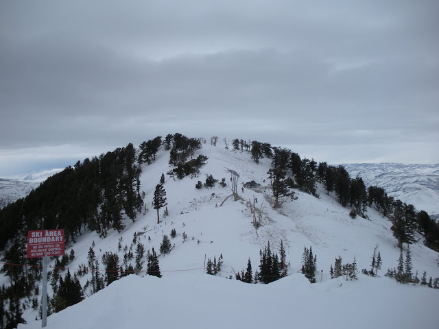
Hiking above the tram was closed:
DSCN0127.JPG


Looking up at the tram:
DSCN0134.JPG


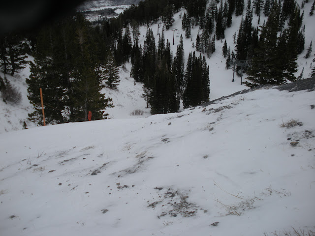
A headwall just below the top of the tram, obviously the wind has hammered this area; reminded me of the area near high rustler at alta, lots of snow around it but bare rocks in spots:

DSCN0137.JPG


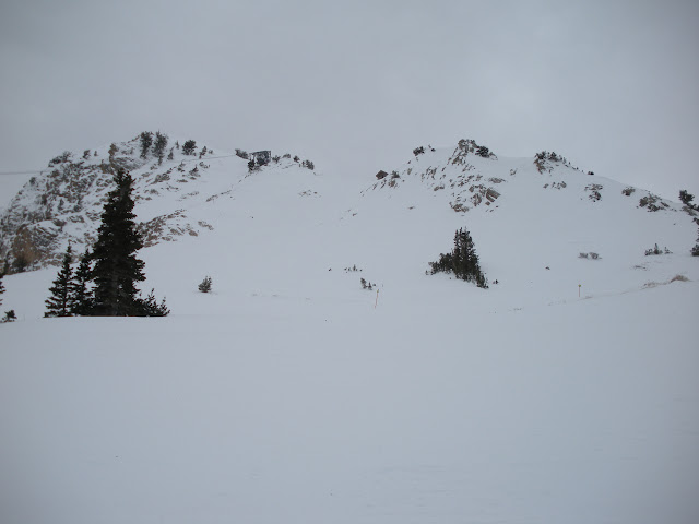
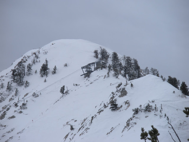
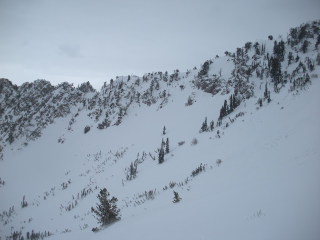
Look at the short hike up No Name Peak (Pretty sure, correct me if I'm wrong):
DSCN0148.JPG


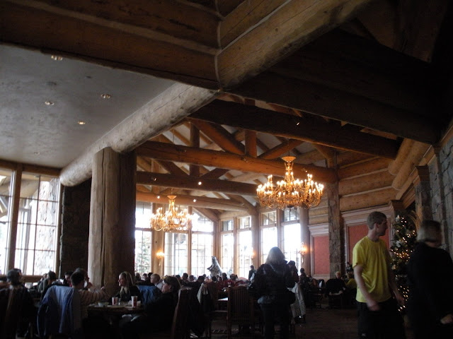
Day Lodge where we at lunch, pretty nice:
DSCN0162.JPG


View of the top of the tram from No Name Peak:
DSCN0157.JPG


Line for Needles Gondola:
DSCN0165.JPG


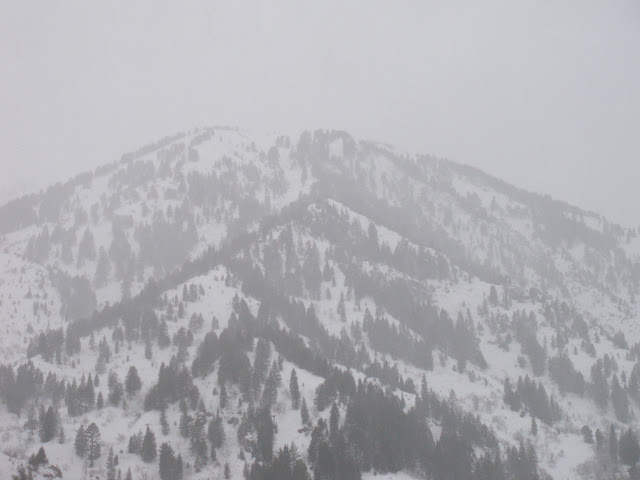
Looking over at Sisters (?, at the skiers far right boundary), I could see hiking up there if it's not too hard and skiing a few of the chutes:
DSCN0168.JPG


Looking up at No Name at around 3pm, it was snowing at the base too:
DSCN0175.JPG


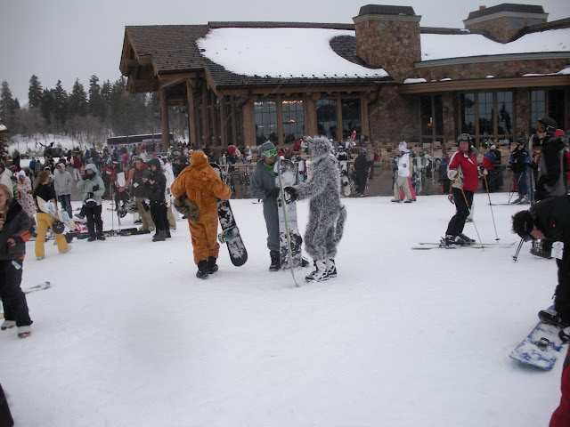
No clue what they were doing, there was also a group of high schoolers right before that had their shirts off in the snow, strange end to the day:
DSCN0170.JPG
 
socal":2um5snzt said:
Looking for some thoughts on where to go tomorrow. Now looks like Snow Basin has 7.75 inches as of 8:30 and according to the NWS the heavy stuff will come later tonight (only in LLC/BCC?). Given the week between storms I think that LCC will be a mad house. BCC probably less so, but Solitude's terrain really just doesn't compare to what we saw at Snow Basin. Thoughts? Suggestions?

That's a tough call. Agreed that LCC will be second only to the Park City resorts for traffic tomorrow (for some insight into the Park City area see http://www.sltrib.com/tourism/ci_11358455 ). However, it'll have to be more than a foot to bring the powder sluts out in droves. If the storm stops at 12" they'll likely largely avoid skiing due to the holiday visitors -- it just isn't enough snow to get the locals' panties in a bunch.

At the moment Snowbasin's SnoTel is reporting 8" and Alta mid-Collins 6" with 3" in the past hour http://www.met.utah.edu/cgi-bin/droman/ ... gi?stn=CLN , but as you pointed out the storm started first in the north and will end there first, too. It didn't start snowing there until between 6 and 7 pm. At my home here at 5,000 feet on Salt Lake City's East Bench at the mouth of Parley's, 12 miles northwest of Alta we're getting steady snowfall at the moment.
 
Admin":2cxccpu2 said:
At the moment Snowbasin's SnoTel is reporting 8" and Alta mid-Collins 6" with 3" in the past hour, but as you pointed out the storm started first in the north and will end there first, too. At my home here at 5,000 feet on Salt Lake City's East Bench at the mouth of Parley's, 12 miles northwest of Alta we're getting steady snowfall at the moment.
Getting hammered in Sandy, too, 2 crow miles from the mouth of LCC. NW flow usually favors the Cottonwood canyons more than anywhere else. But then this is a fast-mover and should mostly be spent by breakfast.
 
We're in Sandy too, it's snowing steady here like marc said.

It is a tough call. Thinking I'll just get up around 5am and check the snowfall then. If there's 10+ at Snowbasin and less than say, 15 at Alta we'll probably hit Snowbasin. My main reason for this is the fact that it'll take a lot of snow to cover those huge bumps all over the mountain at Alta vs. the very small, if any bumps at Snowbasin. The thought of 2000ft steep vertical powder runs is pretty tough to pass on especially given the crowd situation (with or without the locals). Either way we'll probably be at Snowbird on Sunday and get to enjoy whatever didn't open tomorrow (maybe get an Alta/Bird pass and meet up with you guys).

BTW, Utah over Alabama? It's all but done after that fumble.
 
Admin":9vgtvxjj said:
At the moment Snowbasin's SnoTel is reporting 8" and Alta mid-Collins 6" with 3" in the past hour

Interesting to note that Snowbird has received somewhat less thus far:

Snowbird_Snowcam_090102_2128.jpg


socal":9vgtvxjj said:
BTW, Utah over Alabama? It's all but done after that fumble

Proving the pundits wrong once again.
 
My experiences were very similar at snowbasin. The top of the mountain had good snow, the bottom didn't. The best corn run I've ever skied was there. I too have never waited for a line there ever. Of course I've never been there on a powder day. My guess would be the lines would be smaller there or at powder mountain than at LLC or PC during a powder day. One of these years I'm going to take a january vacation out in Utah and stay in Ogden.
 
Saw that too. I can't win (or can't loose depending on how you look at it), but I do want to show my friend around Snowbird so we'll probably be there regardless assuming at least either Mineral Basin or Road to Provo are open.
 
socal":1kats52o said:
Saw that too. I can't win

Don't get too bent out of shape yet. Even though as Marc_C said this storm's a quick mover, it's still early in the game. It only started 3 hours ago there.
 
From the 9 p.m. Winter Weather Advisory:

Periods of snow will continue overnight... with the heaviest snows
in the Salt Lake City area south through Utah County. Snowfall
will taper off beginning late tonight... with most accumulating
snows ending on Saturday morning.

Admittedly that's for the valleys, and the snow will last longer in LCC, but that points out the NWS' thought that snowfall will be greater down here.

From the 4:30 pm forecaster discussion:

Good dynamics and deep moisture remain in place for a period of
intense precipitation near the cold front across northern and
portions of central Utah. This will result in a period of
significant precipitation rates. Valley snowfall is dependent on
when rain changes over to snow. With such a strong cold
front...would expect that the changeover would be fairly quick.
However...there is a chance that the changeover will not occur for
an hour or more after the surface front moves through. Still...a few
inches of snow can be expected in the valleys of northern and
central Utah tonight. The upper-level support will be weaker across
southern Utah...so precipitation will not be as intense there. The
trough axis will shift east of the area tomorrow
afternoon...bringing a drier and more stable airmass into Utah. As a
result...would not expect much precipitation behind the frontal band.

Feel free to call me in the a.m. I'll be up @7 and you have my cell phone.
 
Admin":1u7effsn said:
socal":1u7effsn said:
Saw that too. I can't win

Don't get too bent out of shape yet. Even though as Marc_C said this storm's a quick mover, it's still early in the game. It only started 3 hours ago there.

Honestly just glad to have some new snow. My 6 days at Alta and 2 at Snowbird had a total of <6 inches new so I'm feeling pretty good. I'm sure that when the Alta SNOTEL updates it'll be 8+, and the Snowbasin Mesowest which updates every 5 minutes has slowed considerably.
 
My 6 days at Alta and 2 at Snowbird had a total of <6 inches new
Not that unusual viewtopic.php?f=10&t=6822
So what is the expectation of a 7-day advance-booked trip to Alta between Dec. 1 and Mar. 31?
About 1/4 of weeks (0-23rd percentile) will have no days of 6+ inches.....

Holiday Saturday I'd vote for Snowbasin unless there is a big disparity in storm total vs. LCC. socal's point about mogulled subsurfaces is valid also.
 
couldn't agree more about goin where smoother surfaces are underneath as well as where crowds will be lighter. don't over look deer valley as an option. a little on the pricey side, but on pow days, most stick to the groomers and there's tons of terrain there groomed and ungroomed. go where pow skiers don't, from my times there, it seemed to be fair weather bogner suit skiers.
rog
 
i would go to snowbasin for sure, based on this report the way you played it today made for little to no liftlines. if you were satisfied, then play it the same and you should have tons of pow vert at snowbasin versus what you would have in lcc or pc.
 
This morning's summary from the Utah Avalanche Center:

The cold front that cruised through last night laid down some much needed powder, a fairly even 9” from Ogden down through the Provo mountains, with Little Cottonwood just edging everyone out with 13 inches. Densities are about 7 to 8%. Yesterday's blasting southwesterly winds switched to a more northwesterly direction with frontal passage and dropped into the 10 to 15 mph range, except across the highest peaks. There, wind speeds are still significant, with averages 25 to 35 mph and gusts into 40's. Temperatures have plummeted into the single digits to low teens.
 
Hmmm...perhaps I underestimated this - traffic on Wasatch is stop'n go all the way back to the firehouse!
 
Made the right call coming back to Snow Basin again today. Untracked to be found till 11 (and till about noon under the middle bowl chair) after 12 skiing was still great and the snow up on No Name was knee deep for the first 700 ft or so. Tr wtb pictures (and video if I can figure that out, can I just use the URL from picassa like I do for images?).
 
Interesting, no one uttered the words "Pow Mow"...
Powder Mt. was in very limited operation until about a week ago. There may be some concern about how well covered some of the more interesting terrain is, like the Powder Country bus shuttle runs. However, as socal noted, the lower half of John Paul also takes a lot to get covered and is somewhat of a nuisance to ski in early or low snow conditions. It was fairly sketchy in Feb. 2007.

Another point is that PowMow is so quiet there's no need to go there on the first day of new snow. It might be a good call tomorrow.

We note once again that admin persists with his Alta fixation (I actually agree with icelantic in this rare instance) in the face of holiday crowds. No question I would have gone with socal if I'd been in SLC today.
 
Back
Top