Day 57: Major loss
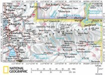
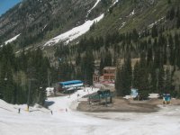
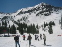
It's amazing what a week with Salt Lake Valley temps +/- 90 will do. Wow, the snow loss on the lower mountain over the course of this week is amazing. They had to push a path of snow to lead back to the Gadzoom loading area. Bare spots have opened up on lower mountain runs like Big Emma, and anything below Little Cloud now requires passing a Forest Service "backcountry area" sign and a hand-written sign stating that recommend skiing is on Little Cloud and in Mineral Basin. With the major loss of lower mountain snow this week, plus the Peruvian Gulch closure, I'm now convinced that they won't remain open past the current May 29 closing date.
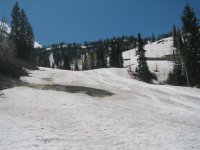
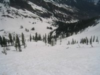
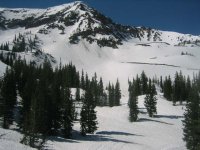
Up high, though, the snowpack remains deep. 100 inches is the official settled snow depth at mid-mountain, and over 8 feet of snow covers plenty. Unfortunately, the warm air means that nothing set up overnight all week, so wallpaper paste ruled the day. Suncups have appeared on ungroomed surfaces. Slow, but fun nonetheless.
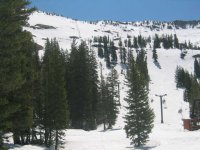
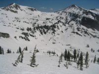
We took 4 runs, 3 in Mineral Basin and one on the front side. For the first run Michael stuck to the groomed Powder Paradise while I traversed out across Hillary Step to the Bookends. The snow on the northeast-facing aspect was gummy, but fun to carve big arcs in down the steep face.
We then struck out to the other side of MBE, Michael taking Lupine Loop while I traversed out to Chamonix I. That was a surprise -- I'd have thought that the south-facing steeps would have been manky, but in fact they skied quite well. So well that we did the same thing again.
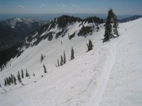
For the last run Michael stuck to skier's right of a closed GS course set up on Mark Malou while I went out the Knucklehead Traverse to the Knucklehead Chutes, down Bassackwards to Big Emma.
Next week should be better. Highs are expected to drop to the low 70s in the Valley beginning Monday, so maybe we'll get a corn cycle set up. This winter seemed to go straight from powder to mashed potatoes, so a bit of corn to round out the diet would be nice.
It's amazing what a week with Salt Lake Valley temps +/- 90 will do. Wow, the snow loss on the lower mountain over the course of this week is amazing. They had to push a path of snow to lead back to the Gadzoom loading area. Bare spots have opened up on lower mountain runs like Big Emma, and anything below Little Cloud now requires passing a Forest Service "backcountry area" sign and a hand-written sign stating that recommend skiing is on Little Cloud and in Mineral Basin. With the major loss of lower mountain snow this week, plus the Peruvian Gulch closure, I'm now convinced that they won't remain open past the current May 29 closing date.
Up high, though, the snowpack remains deep. 100 inches is the official settled snow depth at mid-mountain, and over 8 feet of snow covers plenty. Unfortunately, the warm air means that nothing set up overnight all week, so wallpaper paste ruled the day. Suncups have appeared on ungroomed surfaces. Slow, but fun nonetheless.
We took 4 runs, 3 in Mineral Basin and one on the front side. For the first run Michael stuck to the groomed Powder Paradise while I traversed out across Hillary Step to the Bookends. The snow on the northeast-facing aspect was gummy, but fun to carve big arcs in down the steep face.
We then struck out to the other side of MBE, Michael taking Lupine Loop while I traversed out to Chamonix I. That was a surprise -- I'd have thought that the south-facing steeps would have been manky, but in fact they skied quite well. So well that we did the same thing again.
For the last run Michael stuck to skier's right of a closed GS course set up on Mark Malou while I went out the Knucklehead Traverse to the Knucklehead Chutes, down Bassackwards to Big Emma.
Next week should be better. Highs are expected to drop to the low 70s in the Valley beginning Monday, so maybe we'll get a corn cycle set up. This winter seemed to go straight from powder to mashed potatoes, so a bit of corn to round out the diet would be nice.
Attachments
-
 08 snowbird big emma 060520.jpg55.8 KB · Views: 6,045
 -
 07 snowbird gadzoom base 060520.jpg54.8 KB · Views: 6,041
 -
 06 snowbird little cloud 060520.jpg56 KB · Views: 6,022
 -
 05 snowbird bottom little cloud 060520.jpg56.7 KB · Views: 6,038
 -
 04 snowbird hillary-bookends 060520.jpg51.7 KB · Views: 6,019
 -
 03 snowbird mineral 060520.jpg57.6 KB · Views: 6,024
 -
 02 snowbird bookends 060520.jpg56.9 KB · Views: 6,036
 -
 01 snowbird af twin peaks 060520.jpg59.5 KB · Views: 6,032


")