I didn't ski today. :shock:
I had some stuff to take care of this morning, not the least of which is sleep. Marc_C also called this morning to say that he had to do stuff in the Valley today. Last but not least, it hasn't snowed in about a week. :lol:
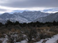
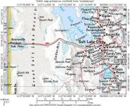
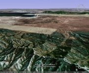
So instead, I headed out early afternoon to the Stansbury Mountains of western Utah, southwest of the Great Salt Lake. This is a spine that runs due north to south, rising abruptly from the desert floor on either side - the Tooele Valley to the east, and the Skull Valley to the west. Friend Todd was going to try his hand at solo winter camping (well, not deep-snow winter camping, but something a bit chillier than in his old home state of Florida). I decided to grab the dogs and tag along as a short day hike, scoping out the area not just for hiking and camping, but also for backcountry skiing. I have a map showing backcountry ski routes, and I wanted to get a feel for the area. The highest point in the range is Deseret Peak at 11,075 feet, but we were to end up considerably north of there by about six miles.
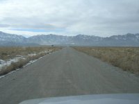
We headed south and then west from Grantsville up Davenport Canyon. Although we passed a vehicle or two on the dirt road covered with mixed slush and mud, we never saw another human being from the time we got to the trailhead. Likewise, we were the only cars parked at the trailhead pull-off.
We headed north on the Stansbury Range Trail which follows the length of the range at about 6,000 to 7,000 feet, crossing each canyon that descends east from the range's spine toward the Tooele Valley. These mountains are beautiful! Unlike others that I've visited around here, these are studded with a mix of sagebrush and cedar trees. The south-facing slopes were covered with patches of snow, making every inch of the trail a muddy squish-fest. The dogs were instantly covered in mud. Ugh.
Reaching a pass along a height of land separating Davenport Canyon from Baker Canyon, Todd decided to set up camp amongst some sagebrush, rock outcroppings, patchy snow and cacti at 6,930 feet with stunning views down Baker Canyon and across the Tooele Valley (and the Tooele Army Depot, where chemical weapons are destroyed) to the northern Oquirrh Mountains. Beneath the inversion haze the Great Salt Lake lay beyond, and behind that the Wasatch Front was bright white as the last rays of sun hit their western slopes ahead of a weak approaching storm system. A half dozen deer were ascending the next ridgeline to our east.
The dogs and I bid Todd farewell and he began gathering firewood and setting up camp as we returned to our truck for the drive home.
This looks like a beautiful area to ski, and I'll head out there one day when the snow is plentiful. The cedars are spaced perfectly for some lazy medium-angle backcountry turns.
Attachments
-
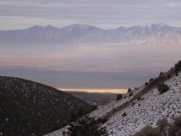 06 tooele valley utah 061209.jpg72.5 KB · Views: 4,766
 -
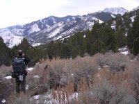 05 todd stansbury mts 061209.jpg103.3 KB · Views: 4,763
 -
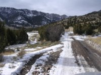 04 davenport canyon stansbury mts utah 061209.jpg104 KB · Views: 4,788
 -
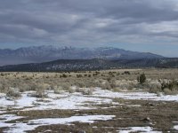 03 oquirrh mts west side utah 061209.jpg89.8 KB · Views: 4,769
 -
 02 deseret peak utah 061209.jpg76.9 KB · Views: 4,791
 -
 01 stansbury mts utah 061209.jpg59.2 KB · Views: 4,761
 -
 00 stansbury mts map.JPG91.2 KB · Views: 4,798
 -
 00 stansbury mts google earth 1 061209.jpg57.6 KB · Views: 4,770
