Everything conspired against me getting there early today. First, my 5am alarm rang at 6. My wife swears up and down that she didn't change it. :?
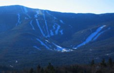
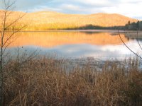
Secondly, I found myself on dirt roads heading south when I wanted to go northeast. Ever since moving back here last year I've been trying to find the best way to reach the Mad River Valley without going over the App Gap. Today's attempt was to follow a road from Rte. 30 in Hubbardton to Rte. 73 in Brandon, up and over Brandon Gap to 100 north. The printer was cranky last night, so I didn't get to print a map and instead relied on memory. Bad move! I ended up on the wrong road, which turned to dirt, then turned south after heading east for about 5 miles. Ugh! Had to backtrack, and eventually found the right road, but to call it "unimproved" was an understatement. At least I saw some beautiful morning views, like in photo #1, below. Oh, well, I'm still looking for that "best way."
Finally, Granville Gulf lived up to its well-deserved reputation as the weather demarcation line. I went from partly cloudy skies to heavy snow and sleet, covered roads, and a 9-degree temperature drop for the remainder of the drive. What was a warm morning in the Champlain Valley (39-40ºF) was now 28 and windy with heavy snow at the Mt. Ellen parking lot at Sugarbush, where I pulled in at 9:10 am.
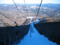
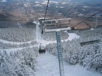
However, today's skiing required uploading and downloading on the Green Mountain (not very) Express Quad, with skiing only of the Summit Quad (see photos #2 & 5, below). So it was 10 am before my skis finally slid off the exit ramp from the Summit Quad and onto Rim Run.
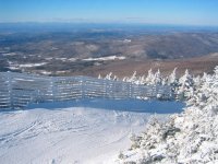
Dang, it was cold today! My thermometer ranged from 17-20ºF all day on top, and the breeze was blowing, too. After this screwy start to the season, my body hasn't had the chance to adjust to winter yet. And it probably didn't help that I forgot to close the pit zips on my jacket until after the 3rd run, either. :roll: (I was wondering why that breeze was "going right through me"!) Visibility was poor for the first couple of runs, but by noon the clouds virtually disappeared and it was as clear as a bell, from Whiteface in the Adirondacks to Mt. Washington on the horizon (see photo #8, below).
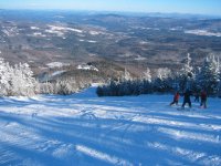
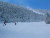
Coverage was good, and all but FIS was groomed out (see photo #3, below). FIS was its usual bumps spaced by sheets of clear ice...yuck! One run down FIS was all I needed, thank you very much. The groomers were in decent shape, but scratchy in spots. The only stones I saw today were at the most windswept point at the top of Rim Run, but that's the case in the best of times.
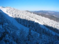
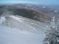
A small jib park was set at the top of Elbow, but the trail is wide enough to accommodate that without disturbing those who wanted to just ski the run. In all honesty, Elbow was the most pleasant skiing of the day (see photo #9, below), floowed a close second by Rim Run/Lower Rim Run (see photos #4 and 7, below).
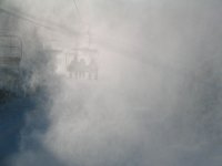
Other than that, they had Spread Eagle open (it's not more than 100 yards or so long) and a cat track to return skiers from Lower Elbow. Guns were going all day in many places on the mountain, including on Lookin' Good below the Summit Quad -- although it hampered visibility on the lift (see photo #6, below), they were blowing dry and not terribly bothersome.
Where they were apparently blowing really wet at one point was on Lower Elbow, which was bulletproof groomer marks and little else. I think that I rattled a tooth or two loose on that one.
Crowds were hardly a bother, as the line for the Summit Quad maxed out at 5 minutes all day. Where people were a problem was in the tiny Glen House mid-mountain snack bar, for that's where you went in to get warm (remember, it was cold today) and also to eat if you didn't want the lengthy round-trip of riding the Green Mountain Express Quad to the base. The Glen House was packed to the rafters, but I still managed to somehow fall asleep on the table for a few minutes during the lunch rush.
By early afternoon, I was already getting somewhat bored with skiing the same couple of trails alone, and opted to download to the base (see photo #10, below) and head on home. Regardless, it was a pleasant way to spend the day, but I only logged 8,333 vertical feet as a result.
And it sure is good to see it starting to look like winter in Vermont!
Attachments
-
 11 sugarbush041205.jpg28.3 KB · Views: 4,817
 -
 10 sugarbush041205.jpg52 KB · Views: 4,801
 -
 09 sugarbush041205.jpg61.2 KB · Views: 4,798
 -
 08 sugarbush041205.jpg56.1 KB · Views: 4,813
 -
 07 sugarbush041205.jpg55.5 KB · Views: 4,803
 -
 06 sugarbush041205.jpg17.2 KB · Views: 4,804
 -
 05 sugarbush041205.jpg45.5 KB · Views: 4,798
 -
 04 sugarbush041205.jpg33.4 KB · Views: 4,804
 -
 03 sugarbush041205.jpg39.4 KB · Views: 4,796
 -
 02 sugarbush041205.jpg59.5 KB · Views: 4,819
 -
 01 sugarbush041205.jpg56.6 KB · Views: 4,803