Telluride opens Palmyra Peak (13,320) & Black Iron Bowl

ChrisC

Well-known member
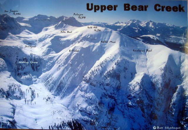
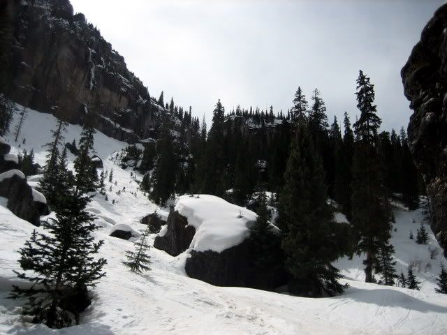
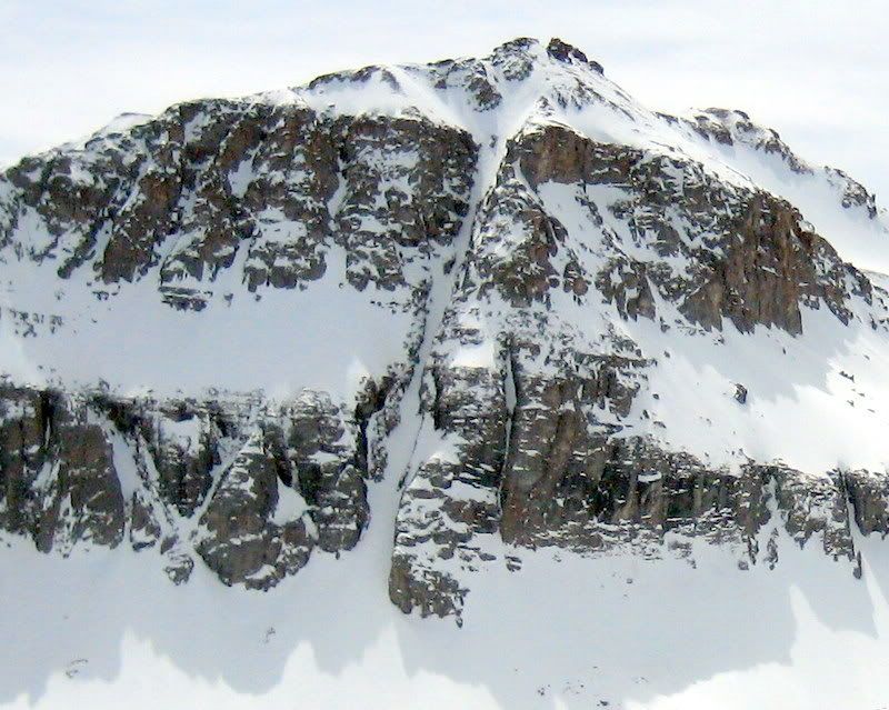
Telluride is opening the entire ridge up until Palmyra Peak. More north-facing 13,000 ft elevation terrain for Telluride! This is some really good / extreme stuff. It's equivalent of Alta's Baldy or Kirkwood's Cirque area. I didn't think they would ever attempt an opening to the summit of Palmyra.

Essentially, everything off this ridge to the left is now skiable. All the way to the summit.
IMG_2971-1.jpg


They were opening the Black Iron Bowl last year in a limited fashion
http://www.firsttracksonline.com/boards ... php?t=3115


Press Release

http://tellurideskiresort.com/TellSki/i ... etail.aspx

OR Telluride Daily Planet

http://www.telluridenews.com/homepage/x870927061
Telski adds yet more extreme hike-to terrain

The ski mountain just won’t stop growing.

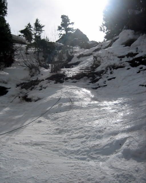
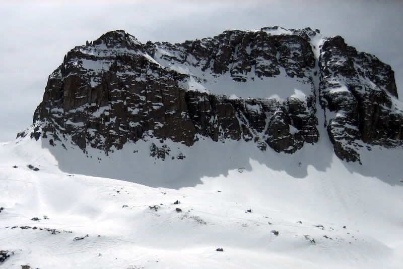
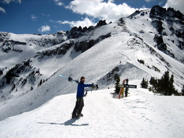
A month after opening a half-dozen new runs of hike-to terrain in the Prospect Basin, Telluride Ski and Golf has upped its ante. Last week, the resort unveiled plans to open the craggy Palmyra Peak to skiers looking for unreal turns down the sheer face of the 13,320-foot mountain.

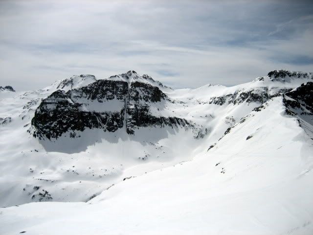
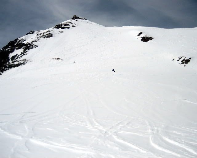
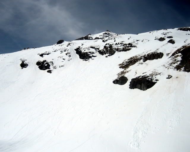
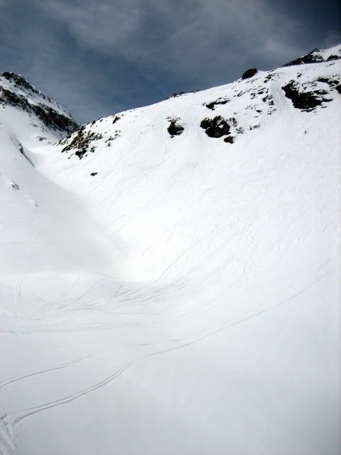
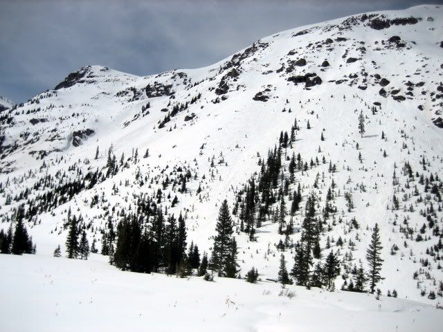
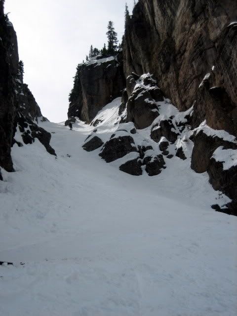
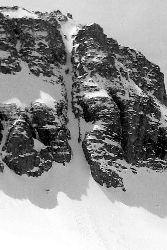
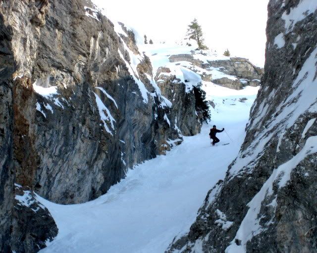
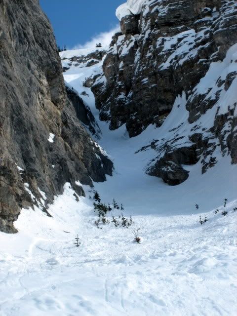
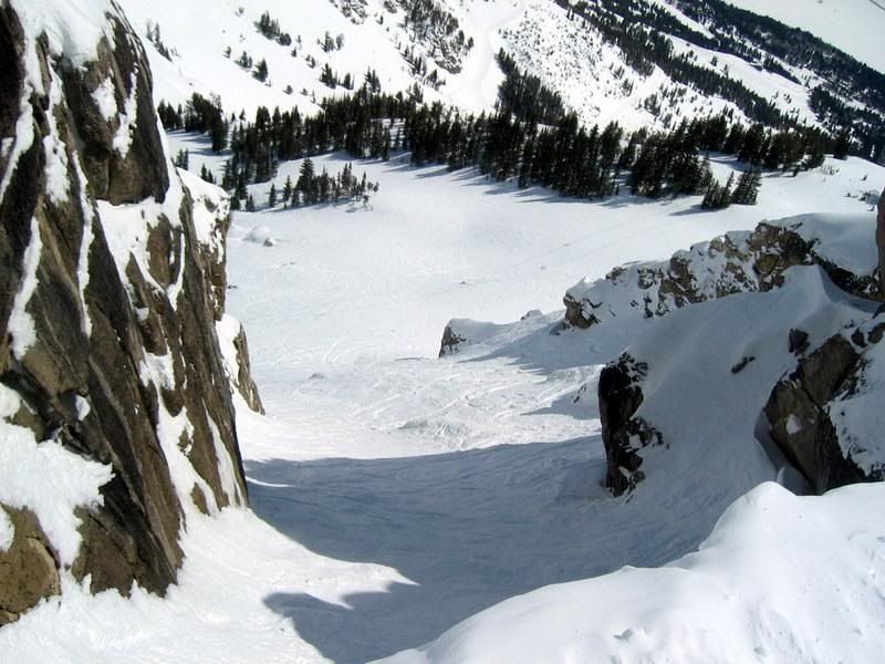
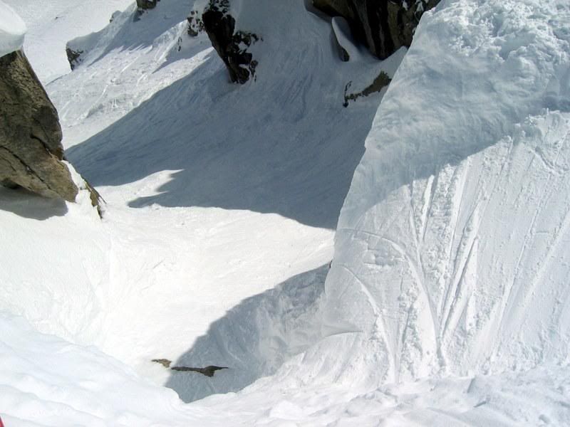
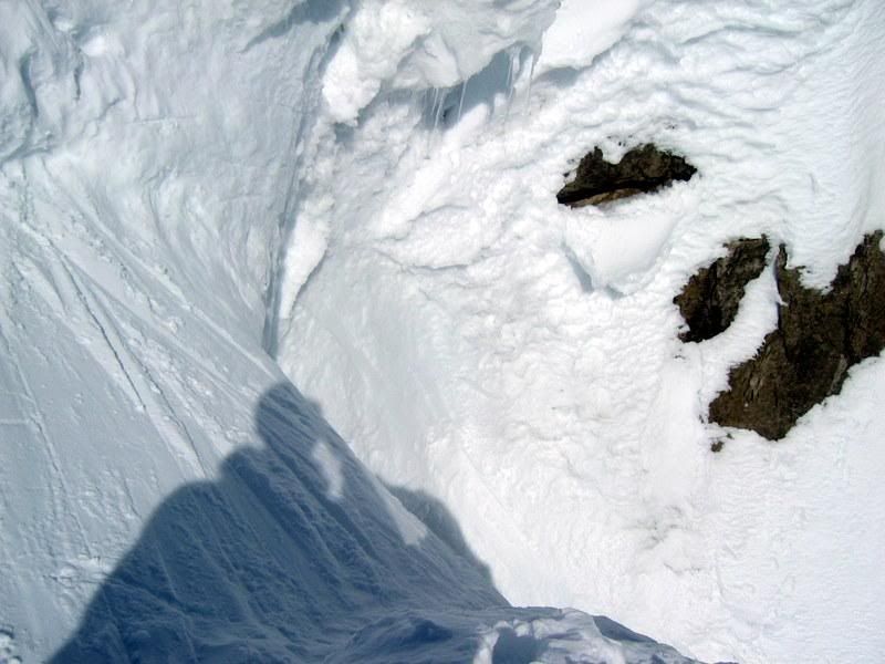
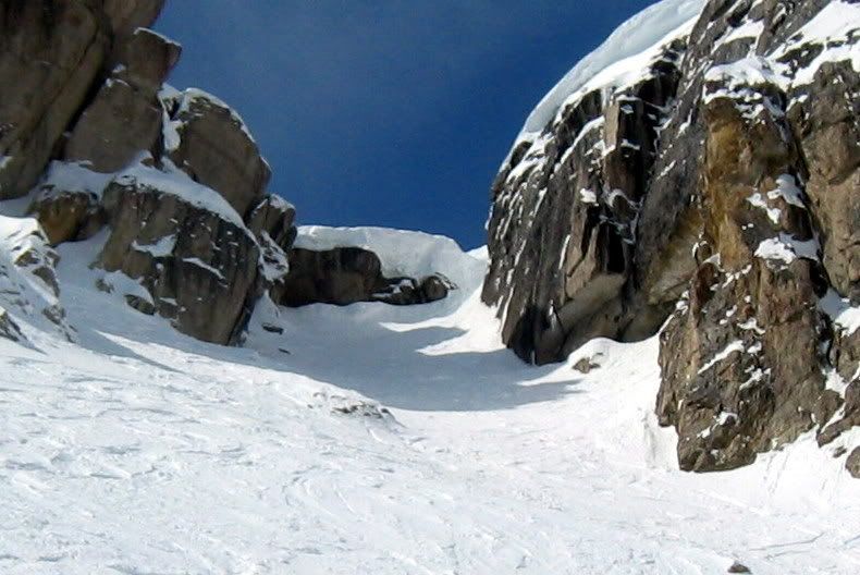
Opening Palmyra adds 200 acres and 2,000 new vertical feet of steep and pure unguided hike-to terrain. It’s a peak that offers mammoth drops, 50-degree chutes, couloirs as skinny as a pig trough and endless views of the Telluride region.

The ropes will drop for unguided skiing and snowboarding as soon as snow conditions permit, Telski said.

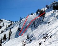
Telski is opening nine named runs on the mountain’s north face. They are dubbed Tram Shot, Sunrise, Electric Shock, Capitol and Sunset, among others. Just glancing at a map of them pulses your adrenal glands, and makes you want to run outside and sacrifice small animals to the gods of snowfall, in hopes that this Indian summer ends soon.

In announcing the opening of Palmyra, Telski called the new runs “some of the most spectacular in-bounds terrain in the country.”

“Palmyra Peak was the natural next step in expanding the area,” said CEO Dave Riley, in a statement. “Telluride has always been known for its legendary terrain, and opening Palmyra Peak will further demonstrate that Telluride Ski Resort is unmatched in North America.”

Riley could not be reached yesterday to talk further about Palmyra.

The ski resort has been on a spending spree lately, buying new snocats and installing new underground snowmaking pipes. Add to that a new avalauncher that made opening Palmyra possible. It will sit at Gold Hill No. 5 and allow Telski to bomb the runs for avalanche control.

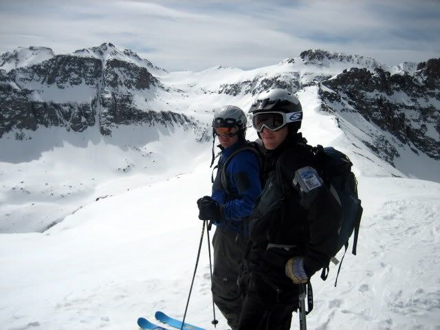
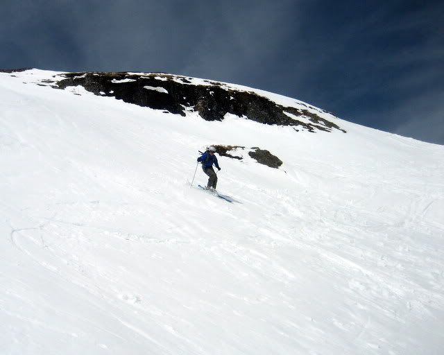
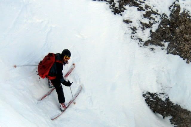
Avid skier Brian O’Neill (have you ever noticed we always call them “avid skiers”? Seriously. Every time.) said skiing Palmyra is an unreal experience.

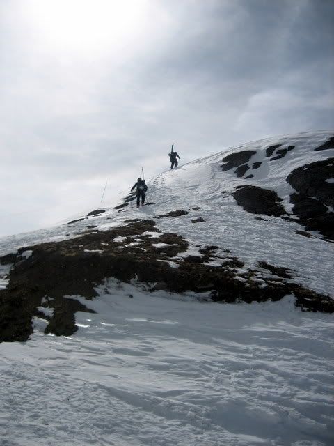
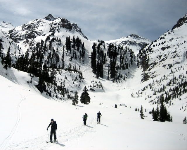
It’s a two-hour climb from Lift 12 to the top of Palmyra, a steep scramble that will wring the air from anybody’s lungs, O’Neill said. But more than worth the effort.

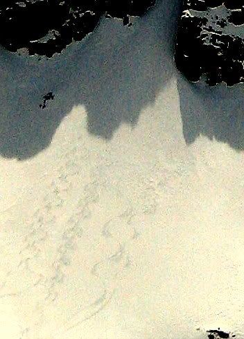
The prevailing winter winds pack snow onto the north face of the mountain, and though the area is naturally prone to breaks and slides, it’s not as fragile or frightening as skiing into Bear Creek.

“It’s a phenomenal ski,” O’Neill said. “I think the northeast face is the money shot. It’s pretty steep off the top — in the high 40s — and once you get halfway down, it starts to ease up.”

Right below Palmyra, of course, is the second-newest addition to Telluride’s hike-to terrain, the Black Iron Bowl. A month ago, Telski opened Mountain Quail and the unforgettable runs next to it for unguided skiing.

This year, dedicated skiers will be able to drop the face of Palmyra into the Black Iron Bowl, then into the bottom of Prospect Basin and catch Lift 12 back to the top. A gold star to the first person who does the full circle three times in a day
 
That's a major hike, at least 2x Baldy at Alta. I will be curious to see how many times ChrisC does this in 2007-08.

I don't recall a report from ChrisC skiing Bear Creek, but I might have missed it. I'd certainly be interested in an eyewitness review of that too.
 
Tony Crocker":294t8ch6 said:
That's a major hike, at least 2x Baldy at Alta. I will be curious to see how many times ChrisC does this in 2007-08.


The hike will definitely will be unpleasant, especially given the altitude. Looks like it will take 1.5-2 hrs. Probably bring lunch and make a half day of it. I would guess it will not be open until Feb 1st/Subaru Freeski.

I don't recall a report from ChrisC skiing Bear Creek, but I might have missed it. I'd certainly be interested in an eyewitness review of that too.

I did one Bear Creek report last spring. Conditions were softening corn on the east aspects with chalky snow in some north chutes. You can easily do laps 4000'+ laps on Bear Creek, since the hike is only about 20-30 min. However, the chance for wet-slides is too high by noon generally.


http://www.firsttracksonline.com/boards ... st&p=17506

Telluride has extensive lift served sidecountry almost Euro-like in scope.

Bear Creek is the most famous - the drainage off the backside that most drool over. Open. Alpine. Waterfalls. It's vertical is about 4000' and spits you out 5 min from Gondola/Chair8.

The problem - the terrain is a death trap with unstable snow, steepness, chutes. This problem eases in the spring. Generally it's quite good from March till May. You need to hike to the top of Gold Hill to avoid the massive cliff bands directly below the Telluride ski area boundary.


An overview of Bear Creek. The highest Telluride lift is in the lower right corner (Chair 14-Gold Hill). The backcountry gate is located at the top of Gold Hill to help idiots avoid cliff bands.
IMG_3226.jpg


Gold Hill hike. The locals (brother and friend) are a little ahead at 13000'.
IMG_3028.jpg


Brown towards Moab, UT
IMG_3030.jpg


White into Bear Creek
IMG_3031.jpg


Brother and friend
IMG_3033.jpg


Fresh corn in Delta Bowl.
IMG_3039.jpg


IMG_3047.jpg


Lots of wet slides
IMG_3052.jpg


IMG_3054.jpg


IMG_3062.jpg


Wedding chutes in background. Still chalky.
IMG_3063.jpg


Canyon narrows towards the base
IMG_3066.jpg


IMG_3070.jpg


Monkey Bars. Rappelling over rocks with rope. A little sketchy.
IMG_3072.jpg
 
Thanks.

If you look at the "White Into Bear Creek" picture, I recall seeing tracks coming out of the thin couloir in the center of the picture on March 29, 2004.

I never asked anyone about Bear Creek in 2004. I probably assumed that after 3 weeks of heat the bottom was likely burned off, unstable or ugly enough conditions not to be worth it. If I had it to do over again, I would at least inquire. We were somewhat acclimated from 4 previous days in Aspen.
 
Tony Crocker":cxvbeuk3 said:
I never asked anyone about Bear Creek in 2004. I probably assumed that after 3 weeks of heat the bottom was likely burned off, unstable or ugly enough conditions not to be worth it. If I had it to do over again, I would at least inquire. We were somewhat acclimated from 4 previous days in Aspen.

With the Gold Hill Lift (#14), it is only a 20-30 minute hike.

Terrain choices.
I almost always hike up and over and drop into Delta Bowl/Wedding Chutes - since it north facing and more moderate terrain/ridge lines/trees allowing you to scan steeper routes/mitigate avy danger. Steeper stuff saved for future runs.

Exit
The bottom/exit of Bear Creek is actually a relatively flat, very popular, well-traveled hiking path. It is used year-round since it is quite wide - almost road-like. You have to be careful of hikers - and especially their dogs!!
 

Attachments

  • IMG_3055.JPG
    IMG_3055.JPG
    21.8 KB · Views: 6,467
Tony Crocker":wqa30id8 said:
If you look at the "White Into Bear Creek" picture, I recall seeing tracks coming out of the thin couloir in the center of the picture on March 29, 2004.

That is the San Joaquin Couloir.

It looks really gnarly! The 1000'+ vertical makes it a no-fall/not-desirable fall zone.

IMG_3049.jpg


IMG_3035-2.jpg


It's popular in the spring and gets great blow in snow. You can see a few sets of tracks in the past week.

IMG_3037-1.jpg


However, it's really not as difficult as it looks. It's an approximate 3 hr traverse/skin and climb from Gold Hill. It's a good 15'+ in most places except for a choke point about 8' wide. (This is near the rock outcropping in the middle of the chute).

IMG_3050-1.jpg


I don't have digitized photos for my descent in late 90s with some 'Telluride Mountaineer' (store) folk.

But it's more this...

IMG_2124.jpg


And less this...

IMG_2128.jpg


IMG_2117.jpg
 
As steep as the Big? Noticeably more difficult than Alta Main Chute? Of course, what kind of shape to ski it would I be in after the 3 hour hike? Maybe more like Portillo's Super C (altitude also) in that regard.
 
Tony Crocker":1q9mutd2 said:
As steep as the Big? Noticeably more difficult than Alta Main Chute? Of course, what kind of shape to ski it would I be in after the 3 hour hike? Maybe more like Portillo's Super C (altitude also) in that regard.

I don't know anything about South American resorts.

Also, I have not done Alta Main Chute. However, based on photos, I think San Joaquin is more difficult since it appears steeper to me.

Big/Extreme/Suadan (whatever-its-name) Couloir, Blackcomb. SJ is much more confined and steeper.

The Big Couloir, Big Sky. This is a more apt comparison. The vertical and exposure upon entrance is similar. However, the San Joaquin does not have a dog-leg bend which provides a rather safe/sheltered resting point half-way.

It's really how confident you are with precise jump-turns for a long period of time in a confined, uncontrolled area that gets the blood pumping. And how must you trust your partner above you.

Some places that this is similar too:
Squaw - some couloirs in the Silverado area
Sugar - one of the Palisade chutes
Sunshine - Wild West couloirs
Alyeaska - parts of XMas/NewYears chutes
Alps
 

Attachments

  • 210_1007-2.JPG
    210_1007-2.JPG
    51.1 KB · Views: 6,433
I was thinking about this some more. It's hard to estimate/compare anything.

Photos can make anything look a little tame. Or conditions fluctuate. Like one afternoon in Jackson Hole in late March when everything was sun-baked/lacking cover - so a few drops into Corbett's to get to its good north-facing snow. It was barely over 5 feet - maybe 7'. Not typical and certainly not reflective of typical conditions.


Catching Corbett's on an easier day/smaller drop.
212_1230.jpg


212_1232.jpg


212_1229.jpg


212_1235-1.jpg
 
I've heard that Corbet's is tougher in good snow years because the cornice piles higher and the initial air becomes 15 - 20 feet.

The Big Couloir at Big Sky is my limit.
 
There are way too many sexy lines out there....and that's my life.

Filled in, stable, let's go.
 
Back
Top