Angeles Forest Fires Waterman/Baldy

Admin":15womhsg said:
Smoke from those fires actually reached SLC yesterday -- the haze in the Valley was amazing.
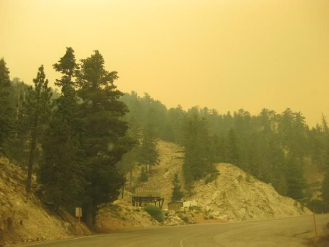
Actually, the plume from the CA fires is dissipating in southern Utah. The haze in the SLC Valley is from our 17 active fires.
 
another map from inciweb, which is now zoomable.. however, it 'may' be generalized and only updated in the morning.

https://165.221.39.44/ftp/InciWeb/CAANF ... 245-0.jpeg

Tom, any word on the 3 people staying behind at Loomis (including someone from Newcombs)? What about T at the top of Waterman..? I'm assuming he left?

thick skies over Waterman today at 2 PM
IMG_2508.jpg


Panorama Point, looking west towards Chilao
IMG_2510.jpg
 
Hi Snowave! Since I'm not involved up there anymore I'm not sure what is going on with people. I'm told the Forest Service all got out of Chilao so I would have to think everyone left Loomis and Newcomb's also.
 
Well, it seems like this is "The Big One" .... i had a real bad feeling about this fire from the get go. They say its the biggest fire in Los Angeles County's history since 1897. I'm just thinking its at Waterman's doorstep right now if its already at Devils Canyon. I'm just numb and devastated. I feel real horrible for the Waterman people and everything they went through. The mountain as we know it might literally be gone tomorrow. We can only hope for a miracle, but right now its not looking good at all. This is just unbelievable.......
 
Thanks, Aukai.

At this point, it looks like only a miracle will save Waterman. Never been there, but I've kept up with news about its comeback, and feel bad for the people who put all that effort behind it.
 
The good news is the advance of the fire slowed considerably overnight or else it would have reached Mt. Waterman. The bad news is the fire is 3 miles away according to Tony's map which detects fire by Satellite or about a mile away if you follow the Los Angeles Times map. The even worse news is the fact that there is no end in sight and it is clearly headed towards the ski areas. I have so many great memories of both Waterman and Kratka. This is horrible news!
 
Nice post of the map and annotation by Aukai. I was not successful trying to do that yesterday.

I got a second hand Forest Service report saying if the fire keeps up at current rate it could be in Wrightwood by Sunday. I sure hope that is just an over exaggeration.
Aukai did not mark Mt. High, but it is at "Big Pines" on the map and would be affected well before Mt. Baldy.

That San Bernardino County fire is near Yucaipa -- nowhere near Baldy. Station fire is closer.
Correct. Yucaipa fire is far from even the San Bernardino Mt. ski areas.

There are worst-case scenarios with every wildfire that don't occur. (A little optimism for you all).
Also correct. The Old Fire in 2003, after destroying hundreds of homes east of Lake Arrowhead, was poised to go all the way to Big Bear. Though that was late October and an early winter storm shut down the fire.

We have overcast today, though it's the tropical variety not that cool. There's also a Class 4 hurricane about to hit Baja today, projected to head due north, remnants likely in the SoCal/Arizona deserts by this weekend. Those storms usually don't get this far west, but you never know.

More planes are due soon to add to firefighting. Top priorities so far as I can see:
1) The L.A. suburbs on the SW perimeter. These have been defended without loss and most of the hillsides above La Canada/La Crescenta are burned already. But that fire line is moving NW and there are new areas to defend in Tujunga, lakeview Terrace, maybe Sylmar.
2) Acton and trying to prevent the fire from getting to or across the 14 freeway.
3) Mt. Wilson and the extensive communication and observatory facilities there.

So far I suspect few if any resources have been put into slowing the advance NE along the Angeles Crest. My guess is that effort will start soon with the added planes. The status of Newcomb Ranch will be a good indicator.
 
Tony Crocker":1zncyfxz said:
So far I suspect few if any resources have been put into slowing the advance NE along the Angeles Crest. My guess is that effort will start soon with the added planes. The status of Newcomb Ranch will be a good indicator.
According to a post on supertopo.com, Newcomb's Ranch has been destroyed.
 
Here is what I am hearing. CalTrans gone. Chilao Visitor center gone. Christian camp gone. Newcomb's missed and survived. Go figure!
 
That last map is a perimeter, doesn't mean everything inside has burned. This is particularly true on the eastern edge, which according to http://www.enplan.com/fires/ has two branches. That is a good map but it has a time lag of 12 hours or so. There are spot flames along the Angeles Crest Hwy in the Chilao area on that map. I don't know exactly which bend on the highway Newcomb Ranch is on.

You can also refer to some more maps here: http://firefighterblog.blogspot.com/
Direct Links:
http://4.bp.blogspot.com/_oZRuj62fehk/S ... C+Station9
http://3.bp.blogspot.com/_oZRuj62fehk/S ... tion19.jpg
http://maps.google.com/maps?f=q&source= ... 1,0.891953

Still a timing issue, last map was at midnight, the other two I don't see a time stamp.

I don't like the odds on Newcomb Ranch based on the maps. I think it will be tomorrow before we know more about the ski area, such as whether the planes will start dropping retardant on that edge of the fire. Live crews are back on Mt. Wilson, cutting fire breaks and putting down retardant.
 
good news is... I was just up on Table Mtn (near Big Pines on the east end of Hwy 2).. and there are alot of fire crews headed west towards Waterman, and the eastern flank of the fire.. Didn't see any of that until today as before now, they've all been coming out from that way.
 
I had the feeling over the weekend that there were not enough firefighting resources on the scene to commit much to the NE edge. We knew more would come eventually. Nice to hear that it's happening today. Unless we get wind from an unfavorable direction, I think they could keep the fire out of the higher mountains. There is not much brush and undergrowth up there.

One problem is the the backside of Mt. Waterman is in the San Gabriel Wilderness, and the fire is definitely in the lower part of that now. Government policy is generally to let nature take its course within wilderness areas. If they let the fire get to the top of Mt. Waterman it will be more difficult to keep it from crossing north into the ski area.

Fire area is now 122,000 acres and 22% contained, whatever that means. Growth is much slower than the past few days.
 
Back
Top