(non-skiing) Backpacking San Rafael Swell, UT

jasoncapecod":i68th32v said:
Great pics and a great way of presenting a trip report
I disagree. I have to download and install software to view the pics...in a site where it's easy to either attach to or include in-line pics with a TR.
 
Admin":1jzmmzk4 said:
Folks down there are getting sick of the restrictions such designations place on the use of their land.
It's not their land, it's owned by all of us. But the inexcusably cheap, well below market value rates the BLM (Bureau of Livestock and Mining) charges for grazing and mining makes the locals think it's their land for however they want to abuse it.
 
Yes, an interesting presentation experiment, appropriate for the off season. In-season I'm with MarcC and want the pics in the report.

I'm a big fan of Google Earth, but the version on my work computer displayed blank pics like Sharon's first attempt. On the home computer the pics work fine, but when I click on a marker, the marker splits into 2x the number of pictures taken from that spot. The time of each picture is shown so you can tell that a marker with the same time stamp is a duplicate of the same picture.

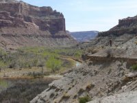
The new version of Google Earth is high resolution of that canyon; Google Earth also has several pictures taken from the road near admin's trailhead.
 
There are no duplicate pix. When the placemarker splits that means that there's more than one photo taken at that spot. Camp, for example, splits several times.
 
I just downloaded the latest update of Google Earth. It's free and WAY COOL.

It seems that Marc_C is not cool enough to download Google Earth.

Marc_C, if you wanna hang with the cool kids, you can even download it for free as well. And I bet you will be glad you did. It makes travel planning all the more interesting and exciting.
 
Or, unfortunately with my 3yr old laptop at home, the new/updated version hangs while drawing the intro (globe) yellow lines. argghhh. For me, I wish I could downgrade back to the version that worked pretty good on that machine (I try to avoid loading such stuff as Google Earth on my work machine as it's not really mine - yeah, I'm one of those).

Oh well.
 
There are no duplicate pix. When the placemarker splits that means that there's more than one photo taken at that spot. Camp, for example, splits several times.
Yes, there are multiple photos from one spot. But they all have time stamps, to the second. On my version of Google Earth the split produces 2 placemarks with identical time stamps for each picture.
 
Yeah, I can't see places like this ever being "on the map". Granted there are many more signs in the area then there were 2 years ago when I was there for the 1st time. I think anyone who knows, knows that the attraction of many places are that they are wilderness. If anyplace is wilderness, southern Utah is (namely San Rafael).

Okay... once shrunk down this picture is not as impressive but I think it pretty much sums up the area.
 

Attachments

  • srs.jpg
    srs.jpg
    109.4 KB · Views: 3,349
Nice photos, M2.

I suggest you do that trip again, but in a canoe. Then use your extra energy to hike up the side canyons. There are tons of Desert Bighorn Sheep and Indian remnants in the area.

Another must do canoe trip in the area is Muddy Creek.

I'm actually considering flying out for a canyoneering trip next April if you're interested in joining me. I'll show you some of my old haunts.
 
rogerk":1i596g0t said:
I'm actually considering flying out for a canyoneering trip next April if you're interested in joining me. I'll show you some of my old haunts.

Absolutely!

During that trip I was eyeballing the river in terms of a 17-foot touring kayak I own. I think it can be run that way.
 
Back
Top